Saint-Just geodata
Saint-Just (Auvergne-Rhône-Alpes) is a populated place; located in France in Europe/Paris (GMT+2) time zone. With population of 867 people, there are 9921 cities with bigger population in this country. Compared to other cities in France, 63.7% of cities are located further ↑North; 80.4% of cities are located further ←West and 75.9% of cities have lower elevation than Saint-Just. Note1
Administrative division(s):
- Level 1: Auvergne-Rhône-Alpes
- Level 2: Département de l'Ain
- Level 3: Arrondissement de Bourg-en-Bresse
- Level 4: Saint-Just


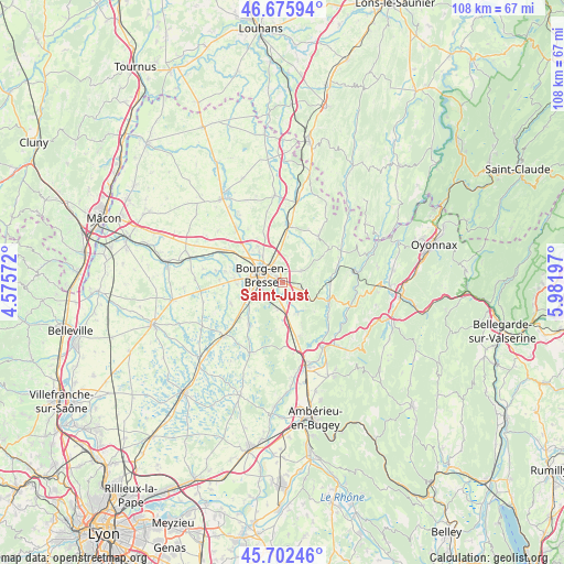
Saint-Just GPS coordinates[2]
46° 11' 28.896" North, 5° 16' 43.824" East
| Map corner | latitude | longitude |
|---|---|---|
| Upper-left | 46.67594°, | 4.57572° |
| Center: | 46.19136°, | 5.27884° |
| Lower-right: | 45.70246°, | 5.98197° |
| Map W x H: | 108.2×108.2 km | = 67.2×67.2mi |
| max Lat: | 51.07786° ⇑63.7% North |
| Saint-Just: | 46.19136° |
| min Lat: | ⇓36.3% South 41.3874° |
| min Long | Saint-Just | max Long |
| -5.08615° | 5.27884° | 9.52242° |
| W 80.4%⇐ | ⇒19.6% E |
Elevation
Elevation of Saint-Just is 256 m = 840 ft, and this is 62.3 m = 204 ft above average elevation for this country.
| Max E: |
2333 m = 7654 ft | 24.1% |
| Saint-Just | 256 m 840 ft | |
| Avg. | 193.7 m = 635 ft | |
Min E: |
-1 m = -3 ft | 75.9% |
See also: France elevation on elevation.city.
Geographical zone
Saint-Just is located in North temperate zone (between Tropic of Cancer and the Arctic Circle). Distance of this North polar circle is 2265.2 km =1407.5 mi to North.| Distance of | km | miles | from Saint-Just |
|---|---|---|---|
| North Pole | 4871.1 | 3026.8 | to North |
| Arctic Circle | 2265.2 | 1407.5 | to North |
| Tropic Cancer | 2530.1 | 1572.1 | to South |
| Equator | 5136 | 3191.4 | to South |


Nearby cities:
15 places around Saint-Just: (largest is in red/bold)
• Bohas-Meyriat-Rignat
9.1 km =5.7 mi,  112°
112°
• Bourg-en-Bresse
4.4 km =2.7 mi,  291°
291°
• Certines
6.6 km =4.1 mi,  189°
189°
• Ceyzériat
3.3 km =2.1 mi, 109°
• Champagne
7.3 km =4.5 mi,  322°
322°
• Jasseron
4.4 km =2.7 mi,  56°
56°
• Meillonnas
8 km =5 mi,  43°
43°
• Montagnat
2.7 km =1.7 mi,  165°
165°
• Péronnas
5.3 km =3.3 mi,  260°
260°
• Revonnas
4.9 km =3 mi,  127°
127°
• Saint-Denis-lès-Bourg
7 km =4.3 mi,  279°
279°
• Saint-Rémy
8.7 km =5.4 mi,  268°
268°
• Tossiat
6.3 km =3.9 mi,  156°
156°
• Villereversure
8 km =5 mi,  94°
94°
• Viriat
8.6 km =5.3 mi,  325°
325°
Sources, notices
• [Note1] Compared only with cities in France existing in our database
• [Src1] Map data: © OpenStreetMap contributors (CC-BY-SA)
• [Src2] Other city data from geonames.org with taken over terms of usage.
• [Src3] Geographical zone / Annual Mean Temperature by Robert A. Rohde @ Wikipedia
