Chainaz-les-Frasses geodata
Chainaz-les-Frasses (Auvergne-Rhône-Alpes) is a populated place; located in France in Europe/Paris (GMT+2) time zone. With population of 578 people, there are 13683 cities with bigger population in this country. Compared to other cities in France, 69.7% of cities are located further ↑North; 87% of cities are located further ←West and 96.5% of cities have lower elevation than Chainaz-les-Frasses. Note1
Administrative division(s):
- Level 1: Auvergne-Rhône-Alpes
- Level 2: Haute-Savoie
- Level 3: Annecy
- Level 4: Chainaz-les-Frasses


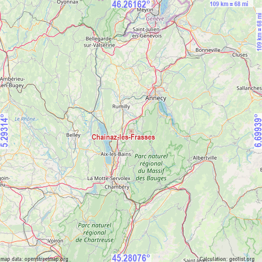
Chainaz-les-Frasses GPS coordinates[2]
45° 46' 24.06" North, 5° 59' 46.536" East
| Map corner | latitude | longitude |
|---|---|---|
| Upper-left | 46.26162°, | 5.29314° |
| Center: | 45.77335°, | 5.99626° |
| Lower-right: | 45.28076°, | 6.69939° |
| Map W x H: | 109.1×109.1 km | = 67.8×67.8mi |
| max Lat: | 51.07786° ⇑69.7% North |
| Chainaz-les-Frasses: | 45.77335° |
| min Lat: | ⇓30.3% South 41.3874° |
| min Long | Chainaz-les-Fra | max Long |
| -5.08615° | 5.99626° | 9.52242° |
| W 87%⇐ | ⇒13% E |
Elevation
Elevation of Chainaz-les-Frasses is 679 m = 2228 ft, and this is 485.3 m = 1592 ft above average elevation for this country.
| Max E: |
2333 m = 7654 ft | 3.5% |
| Chainaz-les-Frasses | 679 m 2228 ft | |
| Avg. | 193.7 m = 635 ft | |
Min E: |
-1 m = -3 ft | 96.5% |
See also: France elevation on elevation.city.
Geographical zone
Chainaz-les-Frasses is located in North temperate zone (between Tropic of Cancer and the Arctic Circle). Distance of this North polar circle is 2311.7 km =1436.4 mi to North.| Distance of | km | miles | from Chainaz-les-Frasses |
|---|---|---|---|
| North Pole | 4917.5 | 3055.6 | to North |
| Arctic Circle | 2311.7 | 1436.4 | to North |
| Tropic Cancer | 2483.6 | 1543.2 | to South |
| Equator | 5089.5 | 3162.5 | to South |


Nearby cities:
15 places around Chainaz-les-Frasses: (largest is in red/bold)
• Albens
4.3 km =2.7 mi,  292°
292°
• Alby-sur-Chéran
5.1 km =3.2 mi,  18°
18°
• Cusy
2.6 km =1.6 mi,  108°
108°
• Gruffy
5 km =3.1 mi,  69°
69°
• Grésy-sur-Aix
7.8 km =4.8 mi,  224°
224°
• Héry-sur-Alby
2.9 km =1.8 mi, 24°
• La Biolle
5.5 km =3.4 mi,  252°
252°
• Marigny-Saint-Marcel
6.5 km =4 mi,  349°
349°
• Montcel
5.5 km =3.4 mi,  190°
190°
• Mûres
4.9 km =3 mi,  41°
41°
• Saint-Félix
3.6 km =2.2 mi,  335°
335°
• Saint-Offenge-dessous
4.4 km =2.7 mi,  172°
172°
• Saint-Ours
1.9 km =1.2 mi,  198°
198°
• Saint-Sylvestre
7.3 km =4.5 mi,  14°
14°
• Viuz-la-Chiésaz
6.9 km =4.3 mi,  51°
51°
Sources, notices
• [Note1] Compared only with cities in France existing in our database
• [Src1] Map data: © OpenStreetMap contributors (CC-BY-SA)
• [Src2] Other city data from geonames.org with taken over terms of usage.
• [Src3] Geographical zone / Annual Mean Temperature by Robert A. Rohde @ Wikipedia
