Albens geodata
Albens (Auvergne-Rhône-Alpes) is a populated place; located in France in Europe/Paris (GMT+2) time zone. With population of 2,854 people, there are 3418 cities with bigger population in this country. Compared to other cities in France, 69.5% of cities are located further ↑North; 86.5% of cities are located further ←West and 85.3% of cities have lower elevation than Albens. Note1
Administrative division(s):
- Level 1: Auvergne-Rhône-Alpes
- Level 2: Savoie
- Level 3: Arrondissement de Chambéry
- Level 4: Entrelacs


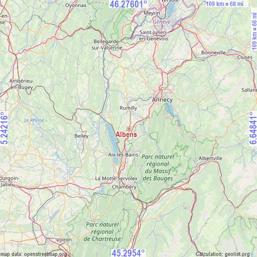
Albens GPS coordinates[2]
45° 47' 16.296" North, 5° 56' 43.008" East
| Map corner | latitude | longitude |
|---|---|---|
| Upper-left | 46.27601°, | 5.24216° |
| Center: | 45.78786°, | 5.94528° |
| Lower-right: | 45.2954°, | 6.64841° |
| Map W x H: | 109×109 km | = 67.7×67.7mi |
| max Lat: | 51.07786° ⇑69.5% North |
| Albens: | 45.78786° |
| min Lat: | ⇓30.5% South 41.3874° |
| min Long | Albens | max Long |
| -5.08615° | 5.94528° | 9.52242° |
| W 86.5%⇐ | ⇒13.5% E |
Elevation
Elevation of Albens is 350 m = 1148 ft, and this is 156.3 m = 513 ft above average elevation for this country.
| Max E: |
2333 m = 7654 ft | 14.7% |
| Albens | 350 m 1148 ft | |
| Avg. | 193.7 m = 635 ft | |
Min E: |
-1 m = -3 ft | 85.3% |
See also: France elevation on elevation.city.
Geographical zone
Albens is located in North temperate zone (between Tropic of Cancer and the Arctic Circle). Distance of this North polar circle is 2310 km =1435.4 mi to North.| Distance of | km | miles | from Albens |
|---|---|---|---|
| North Pole | 4915.9 | 3054.6 | to North |
| Arctic Circle | 2310 | 1435.4 | to North |
| Tropic Cancer | 2485.2 | 1544.2 | to South |
| Equator | 5091.1 | 3163.5 | to South |


Nearby cities:
15 places around Albens: (largest is in red/bold)
• Alby-sur-Chéran
6.4 km =4 mi,  59°
59°
• Chainaz-les-Frasses
4.3 km =2.7 mi,  112°
112°
• Châtillon
8 km =5 mi,  280°
280°
• Cusy
6.9 km =4.3 mi, 110°
• Grésy-sur-Aix
7.4 km =4.6 mi,  192°
192°
• Héry-sur-Alby
5.2 km =3.2 mi,  78°
78°
• La Biolle
3.5 km =2.2 mi,  201°
201°
• Marigny-Saint-Marcel
5.5 km =3.4 mi,  30°
30°
• Massingy
5 km =3.1 mi,  336°
336°
• Montcel
7.6 km =4.7 mi,  157°
157°
• Mûres
7.5 km =4.7 mi,  74°
74°
• Saint-Félix
3 km =1.9 mi, 56°
• Saint-Offenge-dessous
7.4 km =4.6 mi,  142°
142°
• Saint-Ours
4.8 km =3 mi, 135°
• Saint-Sylvestre
7.9 km =4.9 mi,  46°
46°
Sources, notices
• [Note1] Compared only with cities in France existing in our database
• [Src1] Map data: © OpenStreetMap contributors (CC-BY-SA)
• [Src2] Other city data from geonames.org with taken over terms of usage.
• [Src3] Geographical zone / Annual Mean Temperature by Robert A. Rohde @ Wikipedia
