Ceret geodata
Ceret (Occitanie) is a seat of a third-order administrative division; located in France in Europe/Paris (GMT+2) time zone. With population of 8,171 people, there are 1185 cities with bigger population in this country. Compared to other cities in France, 99.5% of cities are located further ↑North; 54.2% of cities are located further ←West and 62.4% of cities have lower elevation than Ceret. Note1
Administrative division(s):
- Level 1: Occitanie
- Level 2: Département des Pyrénées-Orientales
- Level 3: Arrondissement de Céret
- Level 4: Céret


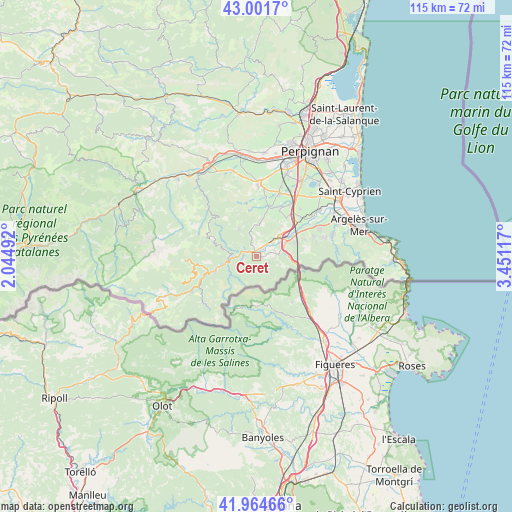
Ceret GPS coordinates[2]
42° 29' 7.188" North, 2° 44' 52.944" East
| Map corner | latitude | longitude |
|---|---|---|
| Upper-left | 43.0017°, | 2.04492° |
| Center: | 42.48533°, | 2.74804° |
| Lower-right: | 41.96466°, | 3.45117° |
| Map W x H: | 115.3×115.3 km | = 71.6×71.6mi |
| max Lat: | 51.07786° ⇑99.5% North |
| Ceret: | 42.48533° |
| min Lat: | ⇓0.5% South 41.3874° |
| min Long | Ceret | max Long |
| -5.08615° | 2.74804° | 9.52242° |
| W 54.2%⇐ | ⇒45.8% E |
Elevation
Elevation of Ceret is 181 m = 594 ft, and this is 12.7 m = 42 ft below average elevation for this country.
| Max E: |
2333 m = 7654 ft | 37.6% |
| Avg. | 193.7 m = 635 ft | |
| Ceret | 181 m = 594 ft | |
Min E: |
-1 m = -3 ft | 62.4% |
See also: France elevation on elevation.city.
Geographical zone
Ceret is located in North temperate zone (between Tropic of Cancer and the Arctic Circle). Distance of this Northern Tropic circle is 2118 km =1316.1 mi to South.| Distance of | km | miles | from Ceret |
|---|---|---|---|
| North Pole | 5283.1 | 3282.8 | to North |
| Arctic Circle | 2677.2 | 1663.5 | to North |
| Tropic Cancer | 2118 | 1316.1 | to South |
| Equator | 4723.9 | 2935.3 | to South |


Nearby cities:
15 places around Ceret: (largest is in red/bold)
• Arles
9.8 km =6.1 mi,  251°
251°
• Banyuls-dels-Aspres
13.2 km =8.2 mi,  47°
47°
• Fourques
10.9 km =6.8 mi,  13°
13°
• Maureillas-las-Illas
4.9 km =3 mi,  83°
83°
• Montesquiu d'Albera
11.6 km =7.2 mi,  71°
71°
• Passa
11.6 km =7.2 mi,  26°
26°
• Reynès
3.5 km =2.2 mi, 254°
• Sant Joan de Pladecorts
4.5 km =2.8 mi, 51°
• Terrats
13.8 km =8.6 mi, 7°
• Tresserre
11 km =6.8 mi,  37°
37°
• Vilallonga dels Monts
13.6 km =8.5 mi, 70°
• Villemolaque
13.6 km =8.5 mi, 33°
• el Pertús
9.6 km =6 mi,  103°
103°
• el Voló
8.2 km =5.1 mi,  58°
58°
• els Banys d'Arles
6.6 km =4.1 mi,  257°
257°
Sources, notices
• [Note1] Compared only with cities in France existing in our database
• [Src1] Map data: © OpenStreetMap contributors (CC-BY-SA)
• [Src2] Other city data from geonames.org with taken over terms of usage.
• [Src3] Geographical zone / Annual Mean Temperature by Robert A. Rohde @ Wikipedia
