Capendu geodata
Capendu (Occitanie) is a populated place; located in France in Europe/Paris (GMT+2) time zone. With population of 1,525 people, there are 6104 cities with bigger population in this country. Compared to other cities in France, 97.2% of cities are located further ↑North; 51.5% of cities are located further ←West and 70.5% of cities have higher elevation than Capendu. Note1
Administrative division(s):
- Level 1: Occitanie
- Level 2: Département de l'Aude
- Level 3: Arrondissement de Carcassonne
- Level 4: Capendu


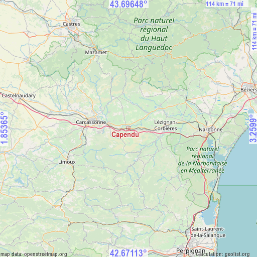
Capendu GPS coordinates[2]
43° 11' 9.456" North, 2° 33' 24.372" East
| Map corner | latitude | longitude |
|---|---|---|
| Upper-left | 43.69648°, | 1.85365° |
| Center: | 43.18596°, | 2.55677° |
| Lower-right: | 42.67113°, | 3.2599° |
| Map W x H: | 114×114 km | = 70.8×70.8mi |
| max Lat: | 51.07786° ⇑97.2% North |
| Capendu: | 43.18596° |
| min Lat: | ⇓2.8% South 41.3874° |
| min Long | Capendu | max Long |
| -5.08615° | 2.55677° | 9.52242° |
| W 51.5%⇐ | ⇒48.5% E |
Elevation
Elevation of Capendu is 77 m = 253 ft, and this is 116.7 m = 383 ft below average elevation for this country.
| Max E: |
2333 m = 7654 ft | 70.5% |
| Avg. | 193.7 m = 635 ft | |
| Capendu | 77 m = 253 ft | |
Min E: |
-1 m = -3 ft | 29.5% |
See also: France elevation on elevation.city.
Geographical zone
Capendu is located in North temperate zone (between Tropic of Cancer and the Arctic Circle). Distance of this Northern Tropic circle is 2195.9 km =1364.5 mi to South.| Distance of | km | miles | from Capendu |
|---|---|---|---|
| North Pole | 5205.2 | 3234.4 | to North |
| Arctic Circle | 2599.3 | 1615.1 | to North |
| Tropic Cancer | 2195.9 | 1364.5 | to South |
| Equator | 4801.8 | 2983.7 | to South |


Nearby cities:
15 places around Capendu: (largest is in red/bold)
• Badens
5.3 km =3.3 mi,  313°
313°
• Barbaira
3.7 km =2.3 mi,  268°
268°
• Berriac
12.2 km =7.6 mi,  284°
284°
• Douzens
3.5 km =2.2 mi,  92°
92°
• Fabrezan
12.7 km =7.9 mi,  115°
115°
• Lagrasse
11.7 km =7.3 mi,  154°
154°
• Laure-Minervois
9.9 km =6.2 mi,  342°
342°
• Malves-en-Minervois
11.2 km =7 mi, 309°
• Marseillette
2.2 km =1.4 mi,  330°
330°
• Montlaur
6.3 km =3.9 mi,  178°
178°
• Moux
7.9 km =4.9 mi,  95°
95°
• Peyriac-Minervois
11.7 km =7.3 mi,  3°
3°
• Puicheric
6.9 km =4.3 mi,  52°
52°
• Rieux-Minervois
10.9 km =6.8 mi,  12°
12°
• Trèbes
9.7 km =6 mi,  286°
286°
Sources, notices
• [Note1] Compared only with cities in France existing in our database
• [Src1] Map data: © OpenStreetMap contributors (CC-BY-SA)
• [Src2] Other city data from geonames.org with taken over terms of usage.
• [Src3] Geographical zone / Annual Mean Temperature by Robert A. Rohde @ Wikipedia
