Montlaur geodata
Montlaur (Occitanie) is a populated place; located in France in Europe/Paris (GMT+2) time zone. With population of 554 people, there are 14131 cities with bigger population in this country. Compared to other cities in France, 97.7% of cities are located further ↑North; 51.5% of cities are located further ←West and 67.4% of cities have lower elevation than Montlaur. Note1
Administrative division(s):
- Level 1: Occitanie
- Level 2: Département de l'Aude
- Level 3: Arrondissement de Carcassonne
- Level 4: Val-de-Dagne


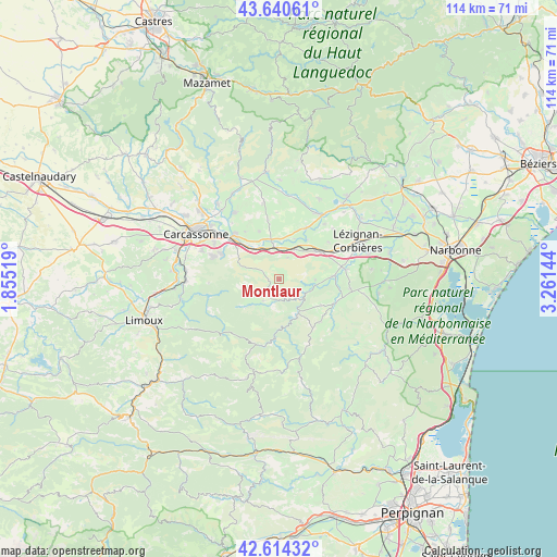
Montlaur GPS coordinates[2]
43° 7' 46.632" North, 2° 33' 29.916" East
| Map corner | latitude | longitude |
|---|---|---|
| Upper-left | 43.64061°, | 1.85519° |
| Center: | 43.12962°, | 2.55831° |
| Lower-right: | 42.61432°, | 3.26144° |
| Map W x H: | 114.1×114.1 km | = 70.9×70.9mi |
| max Lat: | 51.07786° ⇑97.7% North |
| Montlaur: | 43.12962° |
| min Lat: | ⇓2.3% South 41.3874° |
| min Long | Montlaur | max Long |
| -5.08615° | 2.55831° | 9.52242° |
| W 51.5%⇐ | ⇒48.5% E |
Elevation
Elevation of Montlaur is 206 m = 676 ft, and this is 12.3 m = 40 ft above average elevation for this country.
| Max E: |
2333 m = 7654 ft | 32.6% |
| Montlaur | 206 m 676 ft | |
| Avg. | 193.7 m = 635 ft | |
Min E: |
-1 m = -3 ft | 67.4% |
See also: France elevation on elevation.city.
Geographical zone
Montlaur is located in North temperate zone (between Tropic of Cancer and the Arctic Circle). Distance of this Northern Tropic circle is 2189.6 km =1360.6 mi to South.| Distance of | km | miles | from Montlaur |
|---|---|---|---|
| North Pole | 5211.5 | 3238.3 | to North |
| Arctic Circle | 2605.6 | 1619 | to North |
| Tropic Cancer | 2189.6 | 1360.6 | to South |
| Equator | 4795.6 | 2979.8 | to South |


Nearby cities:
15 places around Montlaur: (largest is in red/bold)
• Badens
10.7 km =6.6 mi,  338°
338°
• Barbaira
7.2 km =4.5 mi,  328°
328°
• Berriac
15.1 km =9.4 mi,  307°
307°
• Capendu
6.3 km =3.9 mi,  358°
358°
• Conilhac-Corbières
14.3 km =8.9 mi,  62°
62°
• Douzens
7 km =4.3 mi,  29°
29°
• Fabrezan
11.4 km =7.1 mi,  86°
86°
• Ferrals-les-Corbières
14.4 km =8.9 mi,  80°
80°
• Lagrasse
6.6 km =4.1 mi,  130°
130°
• Marseillette
8.3 km =5.2 mi,  351°
351°
• Moux
9.5 km =5.9 mi,  54°
54°
• Palaja
14.9 km =9.3 mi,  289°
289°
• Puicheric
11.8 km =7.3 mi, 27°
• Saint-Laurent-de-la-Cabrerisse
12.6 km =7.8 mi,  112°
112°
• Trèbes
13.1 km =8.1 mi, 313°
Sources, notices
• [Note1] Compared only with cities in France existing in our database
• [Src1] Map data: © OpenStreetMap contributors (CC-BY-SA)
• [Src2] Other city data from geonames.org with taken over terms of usage.
• [Src3] Geographical zone / Annual Mean Temperature by Robert A. Rohde @ Wikipedia
