Buire geodata
Buire (Hauts-de-France) is a populated place; located in France in Europe/Paris (GMT+2) time zone. With population of 904 people, there are 9617 cities with bigger population in this country. Compared to other cities in France, 93% of cities are located further ↓South; 68.4% of cities are located further ←West and 61.6% of cities have lower elevation than Buire. Note1
Administrative division(s):
- Level 1: Hauts-de-France
- Level 2: Département de l'Aisne
- Level 3: Arrondissement de Vervins
- Level 4: Buire


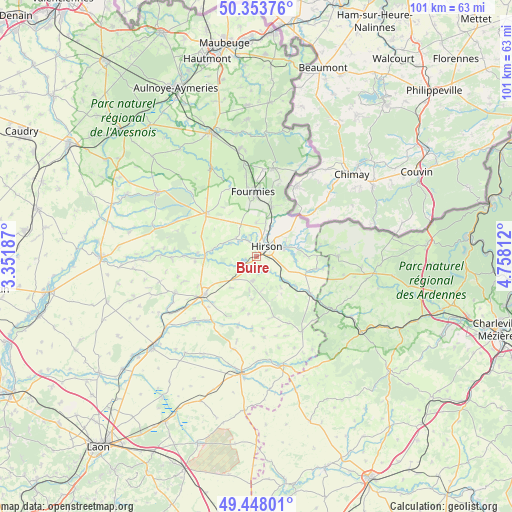
Buire GPS coordinates[2]
49° 54' 10.836" North, 4° 3' 17.964" East
| Map corner | latitude | longitude |
|---|---|---|
| Upper-left | 50.35376°, | 3.35187° |
| Center: | 49.90301°, | 4.05499° |
| Lower-right: | 49.44801°, | 4.75812° |
| Map W x H: | 100.7×100.7 km | = 62.6×62.6mi |
| max Lat: | 51.07786° ⇑7% North |
| Buire: | 49.90301° |
| min Lat: | ⇓93% South 41.3874° |
| min Long | Buire | max Long |
| -5.08615° | 4.05499° | 9.52242° |
| W 68.4%⇐ | ⇒31.6% E |
Elevation
Elevation of Buire is 178 m = 584 ft, and this is 15.7 m = 52 ft below average elevation for this country.
| Max E: |
2333 m = 7654 ft | 38.4% |
| Avg. | 193.7 m = 635 ft | |
| Buire | 178 m = 584 ft | |
Min E: |
-1 m = -3 ft | 61.6% |
See also: France elevation on elevation.city.
Geographical zone
Buire is located in North temperate zone (between Tropic of Cancer and the Arctic Circle). Distance of this North polar circle is 1852.5 km =1151.1 mi to North.| Distance of | km | miles | from Buire |
|---|---|---|---|
| North Pole | 4458.4 | 2770.3 | to North |
| Arctic Circle | 1852.5 | 1151.1 | to North |
| Tropic Cancer | 2942.8 | 1828.6 | to South |
| Equator | 5548.7 | 3447.8 | to South |


Nearby cities:
15 places around Buire: (largest is in red/bold)
• Anor
10.2 km =6.3 mi,  18°
18°
• Any-Martin-Rieux
12.2 km =7.6 mi,  101°
101°
• Clairfontaine
10.1 km =6.3 mi,  332°
332°
• Fontaine-lès-Vervins
12.4 km =7.7 mi,  243°
243°
• Fourmies
12.5 km =7.8 mi,  357°
357°
• Hirson
2.9 km =1.8 mi,  42°
42°
• La Bouteille
7.5 km =4.7 mi,  230°
230°
• La Capelle
12.2 km =7.6 mi,  305°
305°
• Landouzy-la-Ville
4.7 km =2.9 mi,  187°
187°
• Mondrepuis
6.7 km =4.2 mi, 359°
• Neuve-Maison
3.5 km =2.2 mi, 332°
• Origny-en-Thiérache
3 km =1.9 mi,  248°
248°
• Plomion
10.7 km =6.6 mi, 193°
• Saint-Michel
5.9 km =3.7 mi,  71°
71°
• Étréaupont
10.1 km =6.3 mi,  270°
270°
Sources, notices
• [Note1] Compared only with cities in France existing in our database
• [Src1] Map data: © OpenStreetMap contributors (CC-BY-SA)
• [Src2] Other city data from geonames.org with taken over terms of usage.
• [Src3] Geographical zone / Annual Mean Temperature by Robert A. Rohde @ Wikipedia
