Anor geodata
Anor (Hauts-de-France) is a populated place; located in France in Europe/Paris (GMT+2) time zone. With population of 3,195 people, there are 3051 cities with bigger population in this country. Compared to other cities in France, 93.5% of cities are located further ↓South; 68.8% of cities are located further ←West and 71.7% of cities have lower elevation than Anor. Note1
Administrative division(s):
- Level 1: Hauts-de-France
- Level 2: Nord
- Level 3: Avesnes-sur-Helpe
- Level 4: Anor


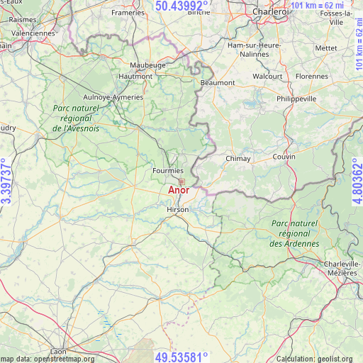
Anor GPS coordinates[2]
49° 59' 23.964" North, 4° 6' 1.764" East
| Map corner | latitude | longitude |
|---|---|---|
| Upper-left | 50.43992°, | 3.39737° |
| Center: | 49.98999°, | 4.10049° |
| Lower-right: | 49.53581°, | 4.80362° |
| Map W x H: | 100.5×100.5 km | = 62.4×62.4mi |
| max Lat: | 51.07786° ⇑6.5% North |
| Anor: | 49.98999° |
| min Lat: | ⇓93.5% South 41.3874° |
| min Long | Anor | max Long |
| -5.08615° | 4.10049° | 9.52242° |
| W 68.8%⇐ | ⇒31.2% E |
Elevation
Elevation of Anor is 228 m = 748 ft, and this is 34.3 m = 113 ft above average elevation for this country.
| Max E: |
2333 m = 7654 ft | 28.3% |
| Anor | 228 m 748 ft | |
| Avg. | 193.7 m = 635 ft | |
Min E: |
-1 m = -3 ft | 71.7% |
See also: France elevation on elevation.city.
Geographical zone
Anor is located in North temperate zone (between Tropic of Cancer and the Arctic Circle). Distance of this North polar circle is 1842.8 km =1145.1 mi to North.| Distance of | km | miles | from Anor |
|---|---|---|---|
| North Pole | 4448.7 | 2764.3 | to North |
| Arctic Circle | 1842.8 | 1145.1 | to North |
| Tropic Cancer | 2952.4 | 1834.5 | to South |
| Equator | 5558.4 | 3453.8 | to South |


Nearby cities:
15 places around Anor: (largest is in red/bold)
• Any-Martin-Rieux
14.8 km =9.2 mi,  144°
144°
• Buire
10.2 km =6.3 mi,  198°
198°
• Clairfontaine
7.9 km =4.9 mi,  264°
264°
• Fourmies
4.7 km =2.9 mi,  306°
306°
• Hirson
7.6 km =4.7 mi,  189°
189°
• La Capelle
13.4 km =8.3 mi, 258°
• La Flamengrie
12.9 km =8 mi,  275°
275°
• Landouzy-la-Ville
14.9 km =9.3 mi, 195°
• Mondrepuis
4.4 km =2.7 mi,  228°
228°
• Neuve-Maison
8.2 km =5.1 mi,  216°
216°
• Origny-en-Thiérache
12.3 km =7.6 mi,  209°
209°
• Sains-du-Nord
13.3 km =8.3 mi,  330°
330°
• Saint-Michel
8.2 km =5.1 mi,  163°
163°
• Trélon
7.6 km =4.7 mi,  0°
0°
• Wignehies
7.1 km =4.4 mi,  293°
293°
Sources, notices
• [Note1] Compared only with cities in France existing in our database
• [Src1] Map data: © OpenStreetMap contributors (CC-BY-SA)
• [Src2] Other city data from geonames.org with taken over terms of usage.
• [Src3] Geographical zone / Annual Mean Temperature by Robert A. Rohde @ Wikipedia
