Origny-en-Thiérache geodata
Origny-en-Thiérache (Hauts-de-France) is a populated place; located in France in Europe/Paris (GMT+2) time zone. With population of 1,456 people, there are 6345 cities with bigger population in this country. Compared to other cities in France, 92.9% of cities are located further ↓South; 68% of cities are located further ←West and 54.2% of cities have lower elevation than Origny-en-Thiérache. Note1
Administrative division(s):
- Level 1: Hauts-de-France
- Level 2: Département de l'Aisne
- Level 3: Arrondissement de Vervins
- Level 4: Origny-en-Thiérache


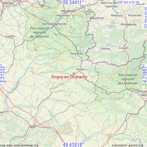
Origny-en-Thiérache GPS coordinates[2]
49° 53' 35.772" North, 4° 0' 59.184" East
| Map corner | latitude | longitude |
|---|---|---|
| Upper-left | 50.34411°, | 3.31332° |
| Center: | 49.89327°, | 4.01644° |
| Lower-right: | 49.43818°, | 4.71957° |
| Map W x H: | 100.7×100.7 km | = 62.6×62.6mi |
| max Lat: | 51.07786° ⇑7.1% North |
| Origny-en-Thiérache: | 49.89327° |
| min Lat: | ⇓92.9% South 41.3874° |
| min Long | Origny-en-Thié | max Long |
| -5.08615° | 4.01644° | 9.52242° |
| W 68%⇐ | ⇒32% E |
Elevation
Elevation of Origny-en-Thiérache is 147 m = 482 ft, and this is 46.7 m = 153 ft below average elevation for this country.
| Max E: |
2333 m = 7654 ft | 45.8% |
| Avg. | 193.7 m = 635 ft | |
| Origny-en-Thiérache | 147 m = 482 ft | |
Min E: |
-1 m = -3 ft | 54.2% |
See also: France elevation on elevation.city.
Geographical zone
Origny-en-Thiérache is located in North temperate zone (between Tropic of Cancer and the Arctic Circle). Distance of this North polar circle is 1853.6 km =1151.8 mi to North.| Distance of | km | miles | from Origny-en-Thiérache |
|---|---|---|---|
| North Pole | 4459.5 | 2771 | to North |
| Arctic Circle | 1853.6 | 1151.8 | to North |
| Tropic Cancer | 2941.7 | 1827.9 | to South |
| Equator | 5547.6 | 3447.1 | to South |


Nearby cities:
15 places around Origny-en-Thiérache: (largest is in red/bold)
• Anor
12.3 km =7.6 mi,  29°
29°
• Buire
3 km =1.9 mi,  68°
68°
• Clairfontaine
10.2 km =6.3 mi,  349°
349°
• Fontaine-lès-Vervins
9.5 km =5.9 mi,  241°
241°
• Hirson
5.8 km =3.6 mi,  55°
55°
• La Bouteille
4.7 km =2.9 mi,  218°
218°
• La Capelle
10.8 km =6.7 mi,  318°
318°
• Landouzy-la-Ville
4.2 km =2.6 mi,  148°
148°
• Mondrepuis
8.3 km =5.2 mi,  19°
19°
• Neuve-Maison
4.3 km =2.7 mi, 15°
• Plomion
9.4 km =5.8 mi,  178°
178°
• Saint-Michel
8.8 km =5.5 mi, 70°
• Vervins
10 km =6.2 mi,  229°
229°
• Wignehies
13.6 km =8.5 mi,  357°
357°
• Étréaupont
7.5 km =4.7 mi,  279°
279°
Sources, notices
• [Note1] Compared only with cities in France existing in our database
• [Src1] Map data: © OpenStreetMap contributors (CC-BY-SA)
• [Src2] Other city data from geonames.org with taken over terms of usage.
• [Src3] Geographical zone / Annual Mean Temperature by Robert A. Rohde @ Wikipedia
