Bourgneuf-en-Retz geodata
Bourgneuf-en-Retz (Pays de la Loire) is a populated place; located in France in Europe/Paris (GMT+2) time zone. With population of 2,591 people, there are 3766 cities with bigger population in this country. Compared to other cities in France, 54.9% of cities are located further ↑North; 94.7% of cities are located further →East and 99% of cities have higher elevation than Bourgneuf-en-Retz. Note1
Administrative division(s):
- Level 1: Pays de la Loire
- Level 2: Loire-Atlantique
- Level 3: Arrondissement de Saint-Nazaire
- Level 4: Villeneuve-en-Retz


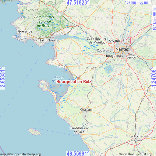
Bourgneuf-en-Retz GPS coordinates[2]
47° 2' 28.392" North, 1° 57' 0.684" West
| Map corner | latitude | longitude |
|---|---|---|
| Upper-left | 47.51823°, | -2.65331° |
| Center: | 47.04122°, | -1.95019° |
| Lower-right: | 46.55991°, | -1.24706° |
| Map W x H: | 106.6×106.6 km | = 66.2×66.2mi |
| max Lat: | 51.07786° ⇑54.9% North |
| Bourgneuf-en-Retz: | 47.04122° |
| min Lat: | ⇓45.1% South 41.3874° |
| min Long | Bourgneuf-en-Re | max Long |
| -5.08615° | -1.95019° | 9.52242° |
| W 5.3%⇐ | ⇒94.7% E |
Elevation
Elevation of Bourgneuf-en-Retz is 6 m = 20 ft, and this is 187.7 m = 616 ft below average elevation for this country.
| Max E: |
2333 m = 7654 ft | 99% |
| Avg. | 193.7 m = 635 ft | |
| Bourgneuf-en-Retz | 6 m = 20 ft | |
Min E: |
-1 m = -3 ft | 1% |
See also: France elevation on elevation.city.
Geographical zone
Bourgneuf-en-Retz is located in North temperate zone (between Tropic of Cancer and the Arctic Circle). Distance of this North polar circle is 2170.7 km =1348.8 mi to North.| Distance of | km | miles | from Bourgneuf-en-Retz |
|---|---|---|---|
| North Pole | 4776.6 | 2968 | to North |
| Arctic Circle | 2170.7 | 1348.8 | to North |
| Tropic Cancer | 2624.6 | 1630.9 | to South |
| Equator | 5230.5 | 3250.1 | to South |


Nearby cities:
15 places around Bourgneuf-en-Retz: (largest is in red/bold)
• Arthon-en-Retz
8.3 km =5.2 mi,  3°
3°
• Beauvoir-sur-Mer
15.9 km =9.9 mi,  205°
205°
• Bois-de-Cené
12.6 km =7.8 mi,  157°
157°
• Bouin
8.4 km =5.2 mi, 205°
• Chauvé
12.6 km =7.8 mi,  347°
347°
• Châteauneuf
13.8 km =8.6 mi,  169°
169°
• Chéméré
8.8 km =5.5 mi,  16°
16°
• Fresnay-en-Retz
5.9 km =3.7 mi,  108°
108°
• La Bernerie-en-Retz
7.9 km =4.9 mi,  303°
303°
• Les Moutiers-en-Retz
4.5 km =2.8 mi, 304°
• Machecoul
11 km =6.8 mi,  118°
118°
• Pornic
13.1 km =8.1 mi,  306°
306°
• Saint-Hilaire-de-Chaléons
9.2 km =5.7 mi,  43°
43°
• Saint-Même-le-Tenu
12 km =7.5 mi,  101°
101°
• Sainte-Pazanne
12.7 km =7.9 mi,  57°
57°
Sources, notices
• [Note1] Compared only with cities in France existing in our database
• [Src1] Map data: © OpenStreetMap contributors (CC-BY-SA)
• [Src2] Other city data from geonames.org with taken over terms of usage.
• [Src3] Geographical zone / Annual Mean Temperature by Robert A. Rohde @ Wikipedia
