Bourg-Blanc geodata
Bourg-Blanc (Brittany) is a populated place; located in France in Europe/Paris (GMT+2) time zone. With population of 3,231 people, there are 3023 cities with bigger population in this country. Compared to other cities in France, 68.3% of cities are located further ↓South; 99.8% of cities are located further →East and 77.8% of cities have higher elevation than Bourg-Blanc. Note1
Administrative division(s):
- Level 1: Brittany
- Level 2: Département du Finistère
- Level 3: Arrondissement de Brest
- Level 4: Bourg-Blanc


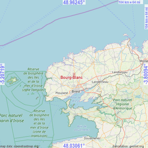
Bourg-Blanc GPS coordinates[2]
48° 29' 55.212" North, 4° 30' 14.616" West
| Map corner | latitude | longitude |
|---|---|---|
| Upper-left | 48.96245°, | -5.20719° |
| Center: | 48.49867°, | -4.50406° |
| Lower-right: | 48.03061°, | -3.80094° |
| Map W x H: | 103.6×103.6 km | = 64.4×64.4mi |
| max Lat: | 51.07786° ⇑31.7% North |
| Bourg-Blanc: | 48.49867° |
| min Lat: | ⇓68.3% South 41.3874° |
| min Long | Bourg-Blanc | max Long |
| -5.08615° | -4.50406° | 9.52242° |
| W 0.2%⇐ | ⇒99.8% E |
Elevation
Elevation of Bourg-Blanc is 60 m = 197 ft, and this is 133.7 m = 439 ft below average elevation for this country.
| Max E: |
2333 m = 7654 ft | 77.8% |
| Avg. | 193.7 m = 635 ft | |
| Bourg-Blanc | 60 m = 197 ft | |
Min E: |
-1 m = -3 ft | 22.2% |
See also: France elevation on elevation.city.
Geographical zone
Bourg-Blanc is located in North temperate zone (between Tropic of Cancer and the Arctic Circle). Distance of this North polar circle is 2008.6 km =1248.1 mi to North.| Distance of | km | miles | from Bourg-Blanc |
|---|---|---|---|
| North Pole | 4614.5 | 2867.3 | to North |
| Arctic Circle | 2008.6 | 1248.1 | to North |
| Tropic Cancer | 2786.6 | 1731.5 | to South |
| Equator | 5392.5 | 3350.7 | to South |


Nearby cities:
15 places around Bourg-Blanc: (largest is in red/bold)
• Bohars
7.7 km =4.8 mi,  184°
184°
• Coat-Méal
3 km =1.9 mi,  291°
291°
• Gouesnou
5.9 km =3.7 mi,  150°
150°
• Guilers
9.1 km =5.7 mi,  206°
206°
• Guipronvel
5.2 km =3.2 mi,  260°
260°
• Kernilis
10.2 km =6.3 mi,  38°
38°
• Kersaint-Plabennec
10.2 km =6.3 mi,  107°
107°
• Lannilis
8.1 km =5 mi,  350°
350°
• Lanrivoaré
10.3 km =6.4 mi,  254°
254°
• Milizac
5.8 km =3.6 mi,  232°
232°
• Plabennec
5.7 km =3.5 mi,  85°
85°
• Plouguin
8 km =5 mi,  298°
298°
• Plouvien
5.5 km =3.4 mi,  45°
45°
• Rd pt des Chataigniers, Rte de Milizac, Guilers, Finistère, France
8.6 km =5.3 mi, 213°
• Tréglonou
6.1 km =3.8 mi,  339°
339°
Sources, notices
• [Note1] Compared only with cities in France existing in our database
• [Src1] Map data: © OpenStreetMap contributors (CC-BY-SA)
• [Src2] Other city data from geonames.org with taken over terms of usage.
• [Src3] Geographical zone / Annual Mean Temperature by Robert A. Rohde @ Wikipedia
