Guilers geodata
Guilers (Brittany) is a populated place; located in France in Europe/Paris (GMT+2) time zone. With population of 7,328 people, there are 1333 cities with bigger population in this country. Compared to other cities in France, 66.8% of cities are located further ↓South; 99.8% of cities are located further →East and 63.6% of cities have higher elevation than Guilers. Note1
Administrative division(s):
- Level 1: Brittany
- Level 2: Département du Finistère
- Level 3: Arrondissement de Brest
- Level 4: Guilers


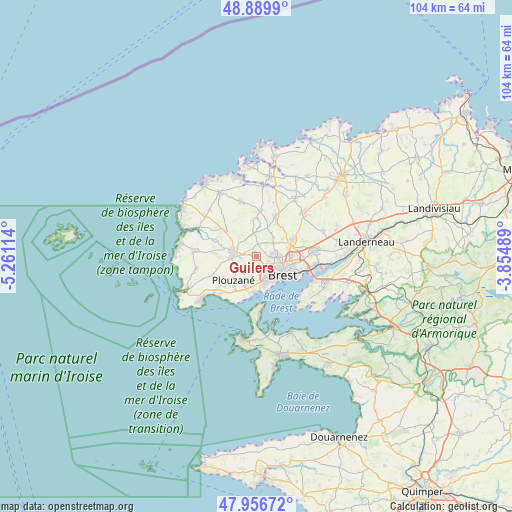
Guilers GPS coordinates[2]
48° 25' 31.62" North, 4° 33' 28.836" West
| Map corner | latitude | longitude |
|---|---|---|
| Upper-left | 48.8899°, | -5.26114° |
| Center: | 48.42545°, | -4.55801° |
| Lower-right: | 47.95672°, | -3.85489° |
| Map W x H: | 103.8×103.8 km | = 64.5×64.5mi |
| max Lat: | 51.07786° ⇑33.2% North |
| Guilers: | 48.42545° |
| min Lat: | ⇓66.8% South 41.3874° |
| min Long | Guilers | max Long |
| -5.08615° | -4.55801° | 9.52242° |
| W 0.2%⇐ | ⇒99.8% E |
Elevation
Elevation of Guilers is 93 m = 305 ft, and this is 100.7 m = 330 ft below average elevation for this country.
| Max E: |
2333 m = 7654 ft | 63.6% |
| Avg. | 193.7 m = 635 ft | |
| Guilers | 93 m = 305 ft | |
Min E: |
-1 m = -3 ft | 36.4% |
See also: France elevation on elevation.city.
Geographical zone
Guilers is located in North temperate zone (between Tropic of Cancer and the Arctic Circle). Distance of this North polar circle is 2016.8 km =1253.2 mi to North.| Distance of | km | miles | from Guilers |
|---|---|---|---|
| North Pole | 4622.7 | 2872.4 | to North |
| Arctic Circle | 2016.8 | 1253.2 | to North |
| Tropic Cancer | 2778.5 | 1726.5 | to South |
| Equator | 5384.4 | 3345.7 | to South |


Nearby cities:
15 places around Guilers: (largest is in red/bold)
• Bohars
3.4 km =2.1 mi,  81°
81°
• Bourg-Blanc
9.1 km =5.7 mi,  26°
26°
• Brest
6.6 km =4.1 mi,  126°
126°
• Coat-Méal
9.3 km =5.8 mi,  7°
7°
• Gouesnou
7.5 km =4.7 mi,  66°
66°
• Guipavas
11.9 km =7.4 mi, 84°
• Guipronvel
7.4 km =4.6 mi,  350°
350°
• Lanrivoaré
8 km =5 mi,  311°
311°
• Le Relecq-Kerhuon
12.3 km =7.6 mi,  99°
99°
• Milizac
4.6 km =2.9 mi, 352°
• Ploumoguer
12 km =7.5 mi,  256°
256°
• Plouzané
6.4 km =4 mi,  222°
222°
• Rd pt des Chataigniers, Rte de Milizac, Guilers, Finistère, France
1.2 km =0.7 mi,  321°
321°
• Roscanvel
12.3 km =7.6 mi,  177°
177°
• Saint-Renan
4.4 km =2.7 mi,  281°
281°
Sources, notices
• [Note1] Compared only with cities in France existing in our database
• [Src1] Map data: © OpenStreetMap contributors (CC-BY-SA)
• [Src2] Other city data from geonames.org with taken over terms of usage.
• [Src3] Geographical zone / Annual Mean Temperature by Robert A. Rohde @ Wikipedia
