Bonningues-lès-Calais geodata
Bonningues-lès-Calais (Hauts-de-France) is a populated place; located in France in Europe/Paris (GMT+2) time zone. With population of 584 people, there are 13570 cities with bigger population in this country. Compared to other cities in France, 99.7% of cities are located further ↓South; 59.7% of cities are located further →East and 72.6% of cities have higher elevation than Bonningues-lès-Calais. Note1
Administrative division(s):
- Level 1: Hauts-de-France
- Level 2: Pas-de-Calais
- Level 3: Arrondissement de Calais
- Level 4: Bonningues-lès-Calais
Current local time in Bonningues-lès-Calais:
05:54 AM, WednesdayDifference from your time zone: hours


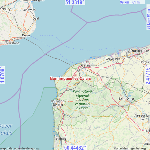
Bonningues-lès-Calais GPS coordinates[2]
50° 53' 25.692" North, 1° 46' 26.472" East
| Map corner | latitude | longitude |
|---|---|---|
| Upper-left | 51.3319°, | 1.0709° |
| Center: | 50.89047°, | 1.77402° |
| Lower-right: | 50.44482°, | 2.47715° |
| Map W x H: | 98.6×98.6 km | = 61.3×61.3mi |
| max Lat: | 51.07786° ⇑0.3% North |
| Bonningues-lès-Calais: | 50.89047° |
| min Lat: | ⇓99.7% South 41.3874° |
| min Long | Bonningues-lès | max Long |
| -5.08615° | 1.77402° | 9.52242° |
| W 40.3%⇐ | ⇒59.7% E |
Elevation
Elevation of Bonningues-lès-Calais is 72 m = 236 ft, and this is 121.7 m = 399 ft below average elevation for this country.
| Max E: |
2333 m = 7654 ft | 72.6% |
| Avg. | 193.7 m = 635 ft | |
| Bonningues-lès-Calais | 72 m = 236 ft | |
Min E: |
-1 m = -3 ft | 27.4% |
See also: France elevation on elevation.city.
Geographical zone
Bonningues-lès-Calais is located in North temperate zone (between Tropic of Cancer and the Arctic Circle). Distance of this North polar circle is 1742.7 km =1082.9 mi to North.| Distance of | km | miles | from Bonningues-lès-Calais |
|---|---|---|---|
| North Pole | 4348.6 | 2702.1 | to North |
| Arctic Circle | 1742.7 | 1082.9 | to North |
| Tropic Cancer | 3052.6 | 1896.8 | to South |
| Equator | 5658.5 | 3516 | to South |


Nearby cities:
15 places around Bonningues-lès-Calais: (largest is in red/bold)
• Calais
8.9 km =5.5 mi,  40°
40°
• Coquelles
5.2 km =3.2 mi,  19°
19°
• Coulogne
8.4 km =5.2 mi,  63°
63°
• Ferques
6.8 km =4.2 mi,  188°
188°
• Fiennes
7.9 km =4.9 mi,  152°
152°
• Fréthun
4.7 km =2.9 mi,  50°
50°
• Guînes
7.2 km =4.5 mi,  111°
111°
• Hames-Boucres
5 km =3.1 mi,  101°
101°
• Landrethun-le-Nord
4.9 km =3 mi,  171°
171°
• Peuplingues
2.7 km =1.7 mi,  346°
346°
• Rinxent
9.8 km =6.1 mi,  198°
198°
• Saint-Inglevert
2.7 km =1.7 mi,  230°
230°
• Saint-Tricat
4 km =2.5 mi,  85°
85°
• Sangatte
6.3 km =3.9 mi, 346°
• Wissant
7.8 km =4.8 mi,  265°
265°
Sources, notices
• [Note1] Compared only with cities in France existing in our database
• [Src1] Map data: © OpenStreetMap contributors (CC-BY-SA)
• [Src2] Other city data from geonames.org with taken over terms of usage.
• [Src3] Geographical zone / Annual Mean Temperature by Robert A. Rohde @ Wikipedia
