Bérat geodata
Bérat (Occitanie) is a populated place; located in France in Europe/Paris (GMT+2) time zone. With population of 1,589 people, there are 5873 cities with bigger population in this country. Compared to other cities in France, 94.5% of cities are located further ↑North; 67% of cities are located further →East and 75% of cities have lower elevation than Bérat. Note1
Administrative division(s):
- Level 1: Occitanie
- Level 2: Haute-Garonne
- Level 3: Arrondissement de Muret
- Level 4: Bérat


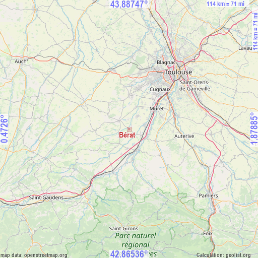
Bérat GPS coordinates[2]
43° 22' 42.852" North, 1° 10' 32.592" East
| Map corner | latitude | longitude |
|---|---|---|
| Upper-left | 43.88747°, | 0.4726° |
| Center: | 43.37857°, | 1.17572° |
| Lower-right: | 42.86536°, | 1.87885° |
| Map W x H: | 113.6×113.6 km | = 70.6×70.6mi |
| max Lat: | 51.07786° ⇑94.5% North |
| Bérat: | 43.37857° |
| min Lat: | ⇓5.5% South 41.3874° |
| min Long | Bérat | max Long |
| -5.08615° | 1.17572° | 9.52242° |
| W 33%⇐ | ⇒67% E |
Elevation
Elevation of Bérat is 249 m = 817 ft, and this is 55.3 m = 181 ft above average elevation for this country.
| Max E: |
2333 m = 7654 ft | 25% |
| Bérat | 249 m 817 ft | |
| Avg. | 193.7 m = 635 ft | |
Min E: |
-1 m = -3 ft | 75% |
See also: France elevation on elevation.city.
Geographical zone
Bérat is located in North temperate zone (between Tropic of Cancer and the Arctic Circle). Distance of this Northern Tropic circle is 2217.3 km =1377.8 mi to South.| Distance of | km | miles | from Bérat |
|---|---|---|---|
| North Pole | 5183.8 | 3221.1 | to North |
| Arctic Circle | 2577.9 | 1601.8 | to North |
| Tropic Cancer | 2217.3 | 1377.8 | to South |
| Equator | 4823.2 | 2997 | to South |


Nearby cities:
15 places around Bérat: (largest is in red/bold)
• Carbonne
9.8 km =6.1 mi,  155°
155°
• Labastidette
10.6 km =6.6 mi,  31°
31°
• Lacasse
7.9 km =4.9 mi,  73°
73°
• Lafitte-Vigordane
8.8 km =5.5 mi,  184°
184°
• Lavernose-Lacasse
7.3 km =4.5 mi, 73°
• Le Fauga
9.9 km =6.2 mi,  78°
78°
• Lherm
7 km =4.3 mi, 32°
• Longages
5.8 km =3.6 mi,  118°
118°
• Marquefave
8.9 km =5.5 mi,  139°
139°
• Mauzac
9.5 km =5.9 mi,  92°
92°
• Noé
8.5 km =5.3 mi,  105°
105°
• Poucharramet
4.3 km =2.7 mi,  357°
357°
• Rieumes
6 km =3.7 mi,  307°
307°
• Saint-Clar-de-Rivière
10.2 km =6.3 mi,  18°
18°
• Saint-Hilaire
9.6 km =6 mi,  59°
59°
Sources, notices
• [Note1] Compared only with cities in France existing in our database
• [Src1] Map data: © OpenStreetMap contributors (CC-BY-SA)
• [Src2] Other city data from geonames.org with taken over terms of usage.
• [Src3] Geographical zone / Annual Mean Temperature by Robert A. Rohde @ Wikipedia
