Labastidette geodata
Labastidette (Occitanie) is a populated place; located in France in Europe/Paris (GMT+2) time zone. With population of 1,501 people, there are 6184 cities with bigger population in this country. Compared to other cities in France, 93.6% of cities are located further ↑North; 66.2% of cities are located further →East and 64.6% of cities have lower elevation than Labastidette. Note1
Administrative division(s):
- Level 1: Occitanie
- Level 2: Haute-Garonne
- Level 3: Arrondissement de Muret
- Level 4: Labastidette


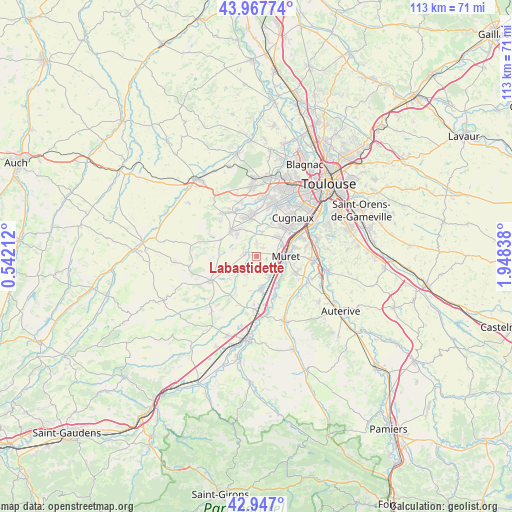
Labastidette GPS coordinates[2]
43° 27' 34.272" North, 1° 14' 42.9" East
| Map corner | latitude | longitude |
|---|---|---|
| Upper-left | 43.96774°, | 0.54212° |
| Center: | 43.45952°, | 1.24525° |
| Lower-right: | 42.947°, | 1.94838° |
| Map W x H: | 113.5×113.5 km | = 70.5×70.5mi |
| max Lat: | 51.07786° ⇑93.6% North |
| Labastidette: | 43.45952° |
| min Lat: | ⇓6.4% South 41.3874° |
| min Long | Labastidette | max Long |
| -5.08615° | 1.24525° | 9.52242° |
| W 33.8%⇐ | ⇒66.2% E |
Elevation
Elevation of Labastidette is 192 m = 630 ft, and this is 1.7 m = 6 ft below average elevation for this country.
| Max E: |
2333 m = 7654 ft | 35.4% |
| Avg. | 193.7 m = 635 ft | |
| Labastidette | 192 m = 630 ft | |
Min E: |
-1 m = -3 ft | 64.6% |
See also: France elevation on elevation.city.
Geographical zone
Labastidette is located in North temperate zone (between Tropic of Cancer and the Arctic Circle). Distance of this Northern Tropic circle is 2226.3 km =1383.4 mi to South.| Distance of | km | miles | from Labastidette |
|---|---|---|---|
| North Pole | 5174.8 | 3215.5 | to North |
| Arctic Circle | 2568.9 | 1596.2 | to North |
| Tropic Cancer | 2226.3 | 1383.4 | to South |
| Equator | 4832.2 | 3002.6 | to South |


Nearby cities:
15 places around Labastidette: (largest is in red/bold)
• Fonsorbes
8.5 km =5.3 mi,  351°
351°
• Frouzins
8.9 km =5.5 mi,  46°
46°
• Lacasse
7 km =4.3 mi,  163°
163°
• Lamasquère
2.6 km =1.6 mi,  1°
1°
• Lavernose-Lacasse
7.1 km =4.4 mi,  168°
168°
• Le Fauga
8.1 km =5 mi,  149°
149°
• Lherm
3.6 km =2.2 mi,  210°
210°
• Muret
6.5 km =4 mi,  89°
89°
• Poucharramet
7.5 km =4.7 mi,  230°
230°
• Saint-Clar-de-Rivière
2.4 km =1.5 mi,  284°
284°
• Saint-Hilaire
4.9 km =3 mi, 147°
• Saint-Lys
8 km =5 mi,  315°
315°
• Sainte-Foy-de-Peyrolières
8.9 km =5.5 mi,  294°
294°
• Saubens
8.9 km =5.5 mi,  75°
75°
• Seysses
6.8 km =4.2 mi, 51°
Sources, notices
• [Note1] Compared only with cities in France existing in our database
• [Src1] Map data: © OpenStreetMap contributors (CC-BY-SA)
• [Src2] Other city data from geonames.org with taken over terms of usage.
• [Src3] Geographical zone / Annual Mean Temperature by Robert A. Rohde @ Wikipedia
