Bagnères-de-Luchon geodata
Bagnères-de-Luchon (Occitanie) is a populated place; located in France in Europe/Paris (GMT+2) time zone. With population of 3,380 people, there are 2879 cities with bigger population in this country. Compared to other cities in France, 98.8% of cities are located further ↑North; 72.4% of cities are located further →East and 95.8% of cities have lower elevation than Bagnères-de-Luchon. Note1
Administrative division(s):
- Level 1: Occitanie
- Level 2: Haute-Garonne
- Level 3: Arrondissement de Saint-Gaudens
- Level 4: Bagnères-de-Luchon


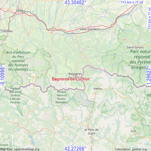
Bagnères-de-Luchon GPS coordinates[2]
42° 47' 26.844" North, 0° 35' 35.34" East
| Map corner | latitude | longitude |
|---|---|---|
| Upper-left | 43.30462°, | -0.10998° |
| Center: | 42.79079°, | 0.59315° |
| Lower-right: | 42.27266°, | 1.29627° |
| Map W x H: | 114.7×114.7 km | = 71.3×71.3mi |
| max Lat: | 51.07786° ⇑98.8% North |
| Bagnères-de-Luchon: | 42.79079° |
| min Lat: | ⇓1.2% South 41.3874° |
| min Long | Bagnères-de-Lu | max Long |
| -5.08615° | 0.59315° | 9.52242° |
| W 27.6%⇐ | ⇒72.4% E |
Elevation
Elevation of Bagnères-de-Luchon is 632 m = 2073 ft, and this is 438.3 m = 1438 ft above average elevation for this country.
| Max E: |
2333 m = 7654 ft | 4.2% |
| Bagnères-de-Luchon | 632 m 2073 ft | |
| Avg. | 193.7 m = 635 ft | |
Min E: |
-1 m = -3 ft | 95.8% |
See also: France elevation on elevation.city.
Geographical zone
Bagnères-de-Luchon is located in North temperate zone (between Tropic of Cancer and the Arctic Circle). Distance of this Northern Tropic circle is 2152 km =1337.2 mi to South.| Distance of | km | miles | from Bagnères-de-Luchon |
|---|---|---|---|
| North Pole | 5249.2 | 3261.7 | to North |
| Arctic Circle | 2643.3 | 1642.5 | to North |
| Tropic Cancer | 2152 | 1337.2 | to South |
| Equator | 4757.9 | 2956.4 | to South |


Nearby cities:
15 places around Bagnères-de-Luchon: (largest is in red/bold)
• Arreau
22.8 km =14.2 mi,  303°
303°
• Aspet
30.2 km =18.8 mi,  34°
34°
• Ausson
32.4 km =20.1 mi,  0°
0°
• Cierp-Gaud
14.4 km =8.9 mi,  13°
13°
• Clarac
34.1 km =21.2 mi, 4°
• Gourdan-Polignan
31.2 km =19.4 mi,  357°
357°
• Hèches
30.8 km =19.1 mi,  324°
324°
• Labarthe-Rivière
32.9 km =20.4 mi, 11°
• Loures-Barousse
26 km =16.2 mi, 2°
• Montréjeau
32.9 km =20.4 mi, 355°
• Pointis-de-Rivière
33 km =20.5 mi, 3°
• Saint-Lary-Soulan
22.3 km =13.9 mi,  277°
277°
• Saint-Laurent-de-Neste
33.2 km =20.6 mi,  344°
344°
• Sarrancolin
26.4 km =16.4 mi, 318°
• Soueich
32.2 km =20 mi, 28°
Sources, notices
• [Note1] Compared only with cities in France existing in our database
• [Src1] Map data: © OpenStreetMap contributors (CC-BY-SA)
• [Src2] Other city data from geonames.org with taken over terms of usage.
• [Src3] Geographical zone / Annual Mean Temperature by Robert A. Rohde @ Wikipedia
