Saint-Lary-Soulan geodata
Saint-Lary-Soulan (Occitanie) is a populated place; located in France in Europe/Paris (GMT+2) time zone. With population of 1,068 people, there are 8349 cities with bigger population in this country. Compared to other cities in France, 98.7% of cities are located further ↑North; 75.1% of cities are located further →East and 98% of cities have lower elevation than Saint-Lary-Soulan. Note1
Administrative division(s):
- Level 1: Occitanie
- Level 2: Département des Hautes-Pyrénées
- Level 3: Arrondissement de Bagnères-de-Bigorre
- Level 4: Saint-Lary-Soulan


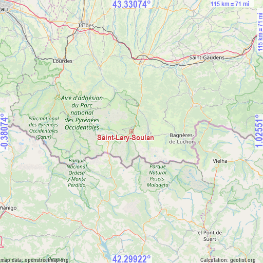
Saint-Lary-Soulan GPS coordinates[2]
42° 49' 1.668" North, 0° 19' 20.568" East
| Map corner | latitude | longitude |
|---|---|---|
| Upper-left | 43.33074°, | -0.38074° |
| Center: | 42.81713°, | 0.32238° |
| Lower-right: | 42.29922°, | 1.02551° |
| Map W x H: | 114.7×114.7 km | = 71.3×71.3mi |
| max Lat: | 51.07786° ⇑98.7% North |
| Saint-Lary-Soulan: | 42.81713° |
| min Lat: | ⇓1.3% South 41.3874° |
| min Long | Saint-Lary-Soul | max Long |
| -5.08615° | 0.32238° | 9.52242° |
| W 24.9%⇐ | ⇒75.1% E |
Elevation
Elevation of Saint-Lary-Soulan is 820 m = 2690 ft, and this is 626.3 m = 2055 ft above average elevation for this country.
| Max E: |
2333 m = 7654 ft | 2% |
| Saint-Lary-Soulan | 820 m 2690 ft | |
| Avg. | 193.7 m = 635 ft | |
Min E: |
-1 m = -3 ft | 98% |
See also: France elevation on elevation.city.
Geographical zone
Saint-Lary-Soulan is located in North temperate zone (between Tropic of Cancer and the Arctic Circle). Distance of this Northern Tropic circle is 2154.9 km =1339 mi to South.| Distance of | km | miles | from Saint-Lary-Soulan |
|---|---|---|---|
| North Pole | 5246.2 | 3259.8 | to North |
| Arctic Circle | 2640.4 | 1640.7 | to North |
| Tropic Cancer | 2154.9 | 1339 | to South |
| Equator | 4760.8 | 2958.2 | to South |


Nearby cities:
15 places around Saint-Lary-Soulan: (largest is in red/bold)
• Arreau
10.2 km =6.3 mi,  17°
17°
• Asté
27.8 km =17.3 mi,  333°
333°
• Avezac-Prat-Lahitte
27.8 km =17.3 mi,  1°
1°
• Bagnères-de-Bigorre
30.9 km =19.2 mi, 332°
• Bagnères-de-Luchon
22.3 km =13.9 mi,  97°
97°
• Campan
25 km =15.5 mi, 332°
• Capvern
31.9 km =19.8 mi,  359°
359°
• Cierp-Gaud
27.7 km =17.2 mi,  66°
66°
• Gerde
29.4 km =18.3 mi, 334°
• Hèches
22.5 km =14 mi,  10°
10°
• La Barthe-de-Neste
29.8 km =18.5 mi, 9°
• Loures-Barousse
32.6 km =20.3 mi,  45°
45°
• Luz-Saint-Sauveur
27.2 km =16.9 mi,  282°
282°
• Saint-Laurent-de-Neste
31.8 km =19.8 mi, 24°
• Sarrancolin
17.5 km =10.9 mi, 15°
Sources, notices
• [Note1] Compared only with cities in France existing in our database
• [Src1] Map data: © OpenStreetMap contributors (CC-BY-SA)
• [Src2] Other city data from geonames.org with taken over terms of usage.
• [Src3] Geographical zone / Annual Mean Temperature by Robert A. Rohde @ Wikipedia
