Ayrens geodata
Ayrens (Auvergne-Rhône-Alpes) is a populated place; located in France in Europe/Paris (GMT+2) time zone. With population of 531 people, there are 14589 cities with bigger population in this country. Compared to other cities in France, 79.7% of cities are located further ↑North; 52.2% of cities are located further →East and 95.3% of cities have lower elevation than Ayrens. Note1
Administrative division(s):
- Level 1: Auvergne-Rhône-Alpes
- Level 2: Cantal
- Level 3: Aurillac
- Level 4: Ayrens


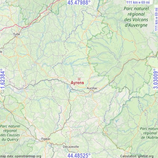
Ayrens GPS coordinates[2]
44° 59' 4.992" North, 2° 19' 37.056" East
| Map corner | latitude | longitude |
|---|---|---|
| Upper-left | 45.47988°, | 1.62384° |
| Center: | 44.98472°, | 2.32696° |
| Lower-right: | 44.48525°, | 3.03009° |
| Map W x H: | 110.6×110.6 km | = 68.7×68.7mi |
| max Lat: | 51.07786° ⇑79.7% North |
| Ayrens: | 44.98472° |
| min Lat: | ⇓20.3% South 41.3874° |
| min Long | Ayrens | max Long |
| -5.08615° | 2.32696° | 9.52242° |
| W 47.8%⇐ | ⇒52.2% E |
Elevation
Elevation of Ayrens is 604 m = 1982 ft, and this is 410.3 m = 1346 ft above average elevation for this country.
| Max E: |
2333 m = 7654 ft | 4.7% |
| Ayrens | 604 m 1982 ft | |
| Avg. | 193.7 m = 635 ft | |
Min E: |
-1 m = -3 ft | 95.3% |
See also: France elevation on elevation.city.
Geographical zone
Ayrens is located in North temperate zone (between Tropic of Cancer and the Arctic Circle). Distance of this Northern Tropic circle is 2395.9 km =1488.7 mi to South.| Distance of | km | miles | from Ayrens |
|---|---|---|---|
| North Pole | 5005.2 | 3110.1 | to North |
| Arctic Circle | 2399.3 | 1490.9 | to North |
| Tropic Cancer | 2395.9 | 1488.7 | to South |
| Equator | 5001.8 | 3108 | to South |


Nearby cities:
15 places around Ayrens: (largest is in red/bold)
• Arpajon-sur-Cère
13.6 km =8.5 mi,  131°
131°
• Aurillac
11.1 km =6.9 mi, 126°
• Jussac
7.6 km =4.7 mi,  87°
87°
• Laroquebrou
10.8 km =6.7 mi,  260°
260°
• Marmanhac
12.4 km =7.7 mi,  80°
80°
• Naucelles
7.8 km =4.8 mi,  111°
111°
• Reilhac
7.5 km =4.7 mi,  99°
99°
• Roannes-Saint-Mary
15.1 km =9.4 mi,  160°
160°
• Saint-Cernin
11 km =6.8 mi,  41°
41°
• Saint-Illide
8.6 km =5.3 mi,  353°
353°
• Saint-Mamet-la-Salvetat
14.2 km =8.8 mi,  186°
186°
• Saint-Paul-des-Landes
4.7 km =2.9 mi, 192°
• Saint-Simon
13 km =8.1 mi, 100°
• Sansac-de-Marmiesse
11.3 km =7 mi,  171°
171°
• Ytrac
8.6 km =5.3 mi, 160°
Sources, notices
• [Note1] Compared only with cities in France existing in our database
• [Src1] Map data: © OpenStreetMap contributors (CC-BY-SA)
• [Src2] Other city data from geonames.org with taken over terms of usage.
• [Src3] Geographical zone / Annual Mean Temperature by Robert A. Rohde @ Wikipedia
