Arpajon-sur-Cère geodata
Arpajon-sur-Cère (Auvergne-Rhône-Alpes) is a populated place; located in France in Europe/Paris (GMT+2) time zone. With population of 5,744 people, there are 1722 cities with bigger population in this country. Compared to other cities in France, 80.4% of cities are located further ↑North; 50.1% of cities are located further →East and 95.5% of cities have lower elevation than Arpajon-sur-Cère. Note1
Administrative division(s):
- Level 1: Auvergne-Rhône-Alpes
- Level 2: Cantal
- Level 3: Aurillac
- Level 4: Arpajon-sur-Cère


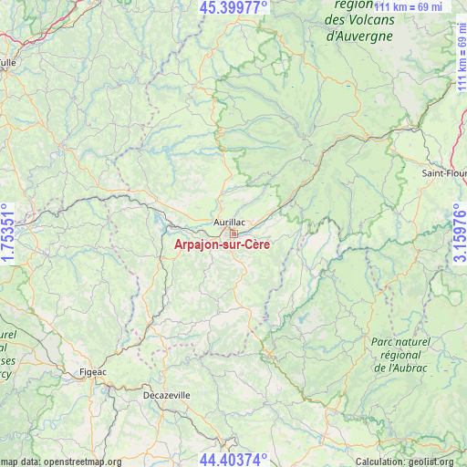
Arpajon-sur-Cère GPS coordinates[2]
44° 54' 14.076" North, 2° 27' 23.904" East
| Map corner | latitude | longitude |
|---|---|---|
| Upper-left | 45.39977°, | 1.75351° |
| Center: | 44.90391°, | 2.45664° |
| Lower-right: | 44.40374°, | 3.15976° |
| Map W x H: | 110.7×110.7 km | = 68.8×68.8mi |
| max Lat: | 51.07786° ⇑80.4% North |
| Arpajon-sur-Cère: | 44.90391° |
| min Lat: | ⇓19.6% South 41.3874° |
| min Long | Arpajon-sur-Cè | max Long |
| -5.08615° | 2.45664° | 9.52242° |
| W 49.9%⇐ | ⇒50.1% E |
Elevation
Elevation of Arpajon-sur-Cère is 613 m = 2011 ft, and this is 419.3 m = 1376 ft above average elevation for this country.
| Max E: |
2333 m = 7654 ft | 4.5% |
| Arpajon-sur-Cère | 613 m 2011 ft | |
| Avg. | 193.7 m = 635 ft | |
Min E: |
-1 m = -3 ft | 95.5% |
See also: France elevation on elevation.city.
Geographical zone
Arpajon-sur-Cère is located in North temperate zone (between Tropic of Cancer and the Arctic Circle). Distance of this Northern Tropic circle is 2386.9 km =1483.2 mi to South.| Distance of | km | miles | from Arpajon-sur-Cère |
|---|---|---|---|
| North Pole | 5014.2 | 3115.7 | to North |
| Arctic Circle | 2408.3 | 1496.4 | to North |
| Tropic Cancer | 2386.9 | 1483.2 | to South |
| Equator | 4992.8 | 3102.4 | to South |


Nearby cities:
15 places around Arpajon-sur-Cère: (largest is in red/bold)
• Aurillac
2.7 km =1.7 mi,  331°
331°
• Giou-de-Mamou
5.5 km =3.4 mi,  55°
55°
• Jussac
9.7 km =6 mi,  344°
344°
• Lafeuillade-en-Vézie
12.7 km =7.9 mi,  178°
178°
• Marmanhac
11.3 km =7 mi,  10°
10°
• Naucelles
6.8 km =4.2 mi, 334°
• Polminhac
10.9 km =6.8 mi, 60°
• Prunet
9.3 km =5.8 mi, 176°
• Reilhac
8.2 km =5.1 mi, 340°
• Roannes-Saint-Mary
7.4 km =4.6 mi,  224°
224°
• Saint-Mamet-la-Salvetat
12.9 km =8 mi,  246°
246°
• Saint-Paul-des-Landes
12 km =7.5 mi,  291°
291°
• Saint-Simon
7.1 km =4.4 mi,  21°
21°
• Sansac-de-Marmiesse
8.9 km =5.5 mi,  255°
255°
• Ytrac
7.5 km =4.7 mi,  276°
276°
Sources, notices
• [Note1] Compared only with cities in France existing in our database
• [Src1] Map data: © OpenStreetMap contributors (CC-BY-SA)
• [Src2] Other city data from geonames.org with taken over terms of usage.
• [Src3] Geographical zone / Annual Mean Temperature by Robert A. Rohde @ Wikipedia
