Atton geodata
Atton (Grand Est) is a populated place; located in France in Europe/Paris (GMT+2) time zone. With population of 708 people, there are 11684 cities with bigger population in this country. Compared to other cities in France, 77.4% of cities are located further ↓South; 88.1% of cities are located further ←West and 65.6% of cities have lower elevation than Atton. Note1
Administrative division(s):
- Level 1: Grand Est
- Level 2: Meurthe-et-Moselle
- Level 3: Arrondissement de Nancy
- Level 4: Atton


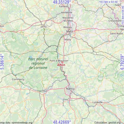
Atton GPS coordinates[2]
48° 53' 28.068" North, 6° 5' 21.336" East
| Map corner | latitude | longitude |
|---|---|---|
| Upper-left | 49.35129°, | 5.38614° |
| Center: | 48.89113°, | 6.08926° |
| Lower-right: | 48.42669°, | 6.79239° |
| Map W x H: | 102.8×102.8 km | = 63.9×63.9mi |
| max Lat: | 51.07786° ⇑22.6% North |
| Atton: | 48.89113° |
| min Lat: | ⇓77.4% South 41.3874° |
| min Long | Atton | max Long |
| -5.08615° | 6.08926° | 9.52242° |
| W 88.1%⇐ | ⇒11.9% E |
Elevation
Elevation of Atton is 197 m = 646 ft, and this is 3.3 m = 11 ft above average elevation for this country.
| Max E: |
2333 m = 7654 ft | 34.4% |
| Atton | 197 m 646 ft | |
| Avg. | 193.7 m = 635 ft | |
Min E: |
-1 m = -3 ft | 65.6% |
See also: France elevation on elevation.city.
Geographical zone
Atton is located in North temperate zone (between Tropic of Cancer and the Arctic Circle). Distance of this North polar circle is 1965 km =1221 mi to North.| Distance of | km | miles | from Atton |
|---|---|---|---|
| North Pole | 4570.9 | 2840.2 | to North |
| Arctic Circle | 1965 | 1221 | to North |
| Tropic Cancer | 2830.3 | 1758.7 | to South |
| Equator | 5436.2 | 3377.9 | to South |


Nearby cities:
15 places around Atton: (largest is in red/bold)
• Belleau
9.7 km =6 mi,  134°
134°
• Belleville
8.2 km =5.1 mi,  172°
172°
• Blénod-lès-Pont-à-Mousson
3.1 km =1.9 mi,  256°
256°
• Cheminot
7.2 km =4.5 mi,  30°
30°
• Dieulouard
5.8 km =3.6 mi,  195°
195°
• Jezainville
4.1 km =2.5 mi,  239°
239°
• Lorry
10.9 km =6.8 mi,  358°
358°
• Louvigny
10.6 km =6.6 mi,  41°
41°
• Maidières
3.7 km =2.3 mi,  284°
284°
• Marbache
10.4 km =6.5 mi, 173°
• Montauville
4.9 km =3 mi, 283°
• Nomeny
10 km =6.2 mi,  90°
90°
• Norroy-lès-Pont-à-Mousson
6.5 km =4 mi,  318°
318°
• Pont-à-Mousson
3 km =1.9 mi,  306°
306°
• Vandières
8 km =5 mi,  329°
329°
Sources, notices
• [Note1] Compared only with cities in France existing in our database
• [Src1] Map data: © OpenStreetMap contributors (CC-BY-SA)
• [Src2] Other city data from geonames.org with taken over terms of usage.
• [Src3] Geographical zone / Annual Mean Temperature by Robert A. Rohde @ Wikipedia
