Burnhaupt-le-Bas geodata
Burnhaupt-le-Bas (Grand Est) is a populated place; located in France in Europe/Paris (GMT+2) time zone. With population of 1,298 people, there are 7038 cities with bigger population in this country. Compared to other cities in France, 54.5% of cities are located further ↓South; 95.6% of cities are located further ←West and 81.1% of cities have lower elevation than Burnhaupt-le-Bas. Note1
Administrative division(s):
- Level 1: Grand Est
- Level 2: Haut-Rhin
- Level 3: Arrondissement de Thann-Guebwiller
- Level 4: Burnhaupt-le-Bas


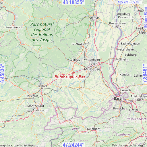
Burnhaupt-le-Bas GPS coordinates[2]
47° 43' 3.504" North, 7° 9' 41.328" East
| Map corner | latitude | longitude |
|---|---|---|
| Upper-left | 48.18855°, | 6.45836° |
| Center: | 47.71764°, | 7.16148° |
| Lower-right: | 47.24244°, | 7.86461° |
| Map W x H: | 105.2×105.2 km | = 65.4×65.4mi |
| max Lat: | 51.07786° ⇑45.5% North |
| Burnhaupt-le-Bas: | 47.71764° |
| min Lat: | ⇓54.5% South 41.3874° |
| min Long | Burnhaupt-le-Ba | max Long |
| -5.08615° | 7.16148° | 9.52242° |
| W 95.6%⇐ | ⇒4.4% E |
Elevation
Elevation of Burnhaupt-le-Bas is 301 m = 988 ft, and this is 107.3 m = 352 ft above average elevation for this country.
| Max E: |
2333 m = 7654 ft | 18.9% |
| Burnhaupt-le-Bas | 301 m 988 ft | |
| Avg. | 193.7 m = 635 ft | |
Min E: |
-1 m = -3 ft | 81.1% |
See also: France elevation on elevation.city.
Geographical zone
Burnhaupt-le-Bas is located in North temperate zone (between Tropic of Cancer and the Arctic Circle). Distance of this North polar circle is 2095.5 km =1302.1 mi to North.| Distance of | km | miles | from Burnhaupt-le-Bas |
|---|---|---|---|
| North Pole | 4701.4 | 2921.3 | to North |
| Arctic Circle | 2095.5 | 1302.1 | to North |
| Tropic Cancer | 2699.8 | 1677.6 | to South |
| Equator | 5305.7 | 3296.8 | to South |


Nearby cities:
15 places around Burnhaupt-le-Bas: (largest is in red/bold)
• Aspach-le-Bas
4.9 km =3 mi,  350°
350°
• Aspach-le-Haut
6.9 km =4.3 mi,  341°
341°
• Balschwiller
5.2 km =3.2 mi,  173°
173°
• Bernwiller
3.6 km =2.2 mi,  144°
144°
• Burnhaupt-le-Haut
2 km =1.2 mi,  320°
320°
• Galfingue
4.9 km =3 mi,  105°
105°
• Guewenheim
6.5 km =4 mi,  307°
307°
• Hagenbach
7.6 km =4.7 mi,  182°
182°
• Heimsbrunn
5 km =3.1 mi,  78°
78°
• Reiningue
6.6 km =4.1 mi,  54°
54°
• Schweighouse-Thann
4 km =2.5 mi,  4°
4°
• Soppe-le-Bas
5.5 km =3.4 mi,  270°
270°
• Soppe-le-Haut
7.7 km =4.8 mi,  282°
282°
• Spechbach-le-Bas
7.2 km =4.5 mi, 136°
• Spechbach-le-Haut
5.6 km =3.5 mi,  134°
134°
Sources, notices
• [Note1] Compared only with cities in France existing in our database
• [Src1] Map data: © OpenStreetMap contributors (CC-BY-SA)
• [Src2] Other city data from geonames.org with taken over terms of usage.
• [Src3] Geographical zone / Annual Mean Temperature by Robert A. Rohde @ Wikipedia
