Ars-sur-Formans geodata
Ars-sur-Formans (Auvergne-Rhône-Alpes) is a populated place; located in France in Europe/Paris (GMT+2) time zone. With population of 1,209 people, there are 7477 cities with bigger population in this country. Compared to other cities in France, 66.3% of cities are located further ↑North; 75.4% of cities are located further ←West and 76.2% of cities have lower elevation than Ars-sur-Formans. Note1
Administrative division(s):
- Level 1: Auvergne-Rhône-Alpes
- Level 2: Département de l'Ain
- Level 3: Arrondissement de Bourg-en-Bresse
- Level 4: Ars-sur-Formans


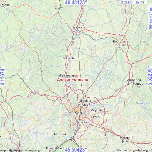
Ars-sur-Formans GPS coordinates[2]
45° 59' 41.676" North, 4° 49' 11.496" East
| Map corner | latitude | longitude |
|---|---|---|
| Upper-left | 46.48123°, | 4.11674° |
| Center: | 45.99491°, | 4.81986° |
| Lower-right: | 45.50428°, | 5.52299° |
| Map W x H: | 108.6×108.6 km | = 67.5×67.5mi |
| max Lat: | 51.07786° ⇑66.3% North |
| Ars-sur-Formans: | 45.99491° |
| min Lat: | ⇓33.7% South 41.3874° |
| min Long | Ars-sur-Formans | max Long |
| -5.08615° | 4.81986° | 9.52242° |
| W 75.4%⇐ | ⇒24.6% E |
Elevation
Elevation of Ars-sur-Formans is 258 m = 846 ft, and this is 64.3 m = 211 ft above average elevation for this country.
| Max E: |
2333 m = 7654 ft | 23.8% |
| Ars-sur-Formans | 258 m 846 ft | |
| Avg. | 193.7 m = 635 ft | |
Min E: |
-1 m = -3 ft | 76.2% |
See also: France elevation on elevation.city.
Geographical zone
Ars-sur-Formans is located in North temperate zone (between Tropic of Cancer and the Arctic Circle). Distance of this North polar circle is 2287 km =1421.1 mi to North.| Distance of | km | miles | from Ars-sur-Formans |
|---|---|---|---|
| North Pole | 4892.9 | 3040.3 | to North |
| Arctic Circle | 2287 | 1421.1 | to North |
| Tropic Cancer | 2508.2 | 1558.5 | to South |
| Equator | 5114.2 | 3177.8 | to South |


Nearby cities:
15 places around Ars-sur-Formans: (largest is in red/bold)
• Ambérieux-en-Dombes
6.3 km =3.9 mi,  85°
85°
• Beauregard
5.1 km =3.2 mi,  275°
275°
• Chaleins
4.2 km =2.6 mi,  347°
347°
• Fareins
5.3 km =3.3 mi,  300°
300°
• Frans
3.2 km =2 mi,  266°
266°
• Jassans-Riottier
4.8 km =3 mi,  251°
251°
• Misérieux
2.3 km =1.4 mi,  192°
192°
• Rancé
5.1 km =3.2 mi,  129°
129°
• Reyrieux
6.6 km =4.1 mi,  183°
183°
• Saint-Didier-de-Formans
4.8 km =3 mi,  215°
215°
• Saint-Jean-de-Thurigneux
6.9 km =4.3 mi, 134°
• Sainte-Euphémie
3.1 km =1.9 mi,  211°
211°
• Savigneux
2.2 km =1.4 mi,  73°
73°
• Toussieux
4.2 km =2.6 mi,  166°
166°
• Villeneuve
3.2 km =2 mi,  23°
23°
Sources, notices
• [Note1] Compared only with cities in France existing in our database
• [Src1] Map data: © OpenStreetMap contributors (CC-BY-SA)
• [Src2] Other city data from geonames.org with taken over terms of usage.
• [Src3] Geographical zone / Annual Mean Temperature by Robert A. Rohde @ Wikipedia
