Misérieux geodata
Misérieux (Auvergne-Rhône-Alpes) is a populated place; located in France in Europe/Paris (GMT+2) time zone. With population of 1,965 people, there are 4868 cities with bigger population in this country. Compared to other cities in France, 66.5% of cities are located further ↑North; 75.3% of cities are located further ←West and 75.1% of cities have lower elevation than Misérieux. Note1
Administrative division(s):
- Level 1: Auvergne-Rhône-Alpes
- Level 2: Département de l'Ain
- Level 3: Arrondissement de Bourg-en-Bresse
- Level 4: Misérieux


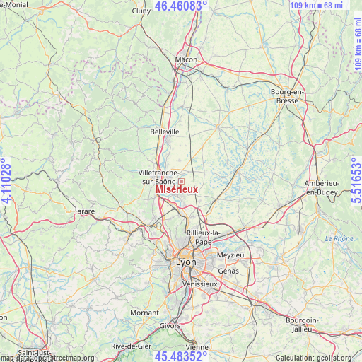
Misérieux GPS coordinates[2]
45° 58' 27.588" North, 4° 48' 48.24" East
| Map corner | latitude | longitude |
|---|---|---|
| Upper-left | 46.46083°, | 4.11028° |
| Center: | 45.97433°, | 4.8134° |
| Lower-right: | 45.48352°, | 5.51653° |
| Map W x H: | 108.7×108.7 km | = 67.5×67.5mi |
| max Lat: | 51.07786° ⇑66.5% North |
| Misérieux: | 45.97433° |
| min Lat: | ⇓33.5% South 41.3874° |
| min Long | Misérieux | max Long |
| -5.08615° | 4.8134° | 9.52242° |
| W 75.3%⇐ | ⇒24.7% E |
Elevation
Elevation of Misérieux is 250 m = 820 ft, and this is 56.3 m = 185 ft above average elevation for this country.
| Max E: |
2333 m = 7654 ft | 24.9% |
| Misérieux | 250 m 820 ft | |
| Avg. | 193.7 m = 635 ft | |
Min E: |
-1 m = -3 ft | 75.1% |
See also: France elevation on elevation.city.
Geographical zone
Misérieux is located in North temperate zone (between Tropic of Cancer and the Arctic Circle). Distance of this North polar circle is 2289.3 km =1422.5 mi to North.| Distance of | km | miles | from Misérieux |
|---|---|---|---|
| North Pole | 4895.2 | 3041.7 | to North |
| Arctic Circle | 2289.3 | 1422.5 | to North |
| Tropic Cancer | 2505.9 | 1557.1 | to South |
| Equator | 5111.9 | 3176.4 | to South |


Nearby cities:
15 places around Misérieux: (largest is in red/bold)
• Ars-sur-Formans
2.3 km =1.4 mi,  12°
12°
• Beauregard
5.3 km =3.3 mi,  301°
301°
• Chaleins
6.4 km =4 mi,  356°
356°
• Fareins
6.4 km =4 mi,  321°
321°
• Frans
3.4 km =2.1 mi,  307°
307°
• Jassans-Riottier
4.1 km =2.5 mi,  280°
280°
• Rancé
4.5 km =2.8 mi,  101°
101°
• Reyrieux
4.3 km =2.7 mi,  178°
178°
• Saint-Didier-de-Formans
2.8 km =1.7 mi,  234°
234°
• Saint-Jean-de-Thurigneux
6 km =3.7 mi,  114°
114°
• Sainte-Euphémie
1.2 km =0.7 mi,  252°
252°
• Savigneux
3.9 km =2.4 mi,  41°
41°
• Toussieux
2.3 km =1.4 mi,  140°
140°
• Trévoux
4.8 km =3 mi,  222°
222°
• Villeneuve
5.5 km =3.4 mi,  18°
18°
Sources, notices
• [Note1] Compared only with cities in France existing in our database
• [Src1] Map data: © OpenStreetMap contributors (CC-BY-SA)
• [Src2] Other city data from geonames.org with taken over terms of usage.
• [Src3] Geographical zone / Annual Mean Temperature by Robert A. Rohde @ Wikipedia
