Ars-en-Ré geodata
Ars-en-Ré (Nouvelle-Aquitaine) is a populated place; located in France in Europe/Paris (GMT+2) time zone. With population of 1,444 people, there are 6409 cities with bigger population in this country. Compared to other cities in France, 63.5% of cities are located further ↑North; 92.5% of cities are located further →East and 99.6% of cities have higher elevation than Ars-en-Ré. Note1
Administrative division(s):
- Level 1: Nouvelle-Aquitaine
- Level 2: Charente-Maritime
- Level 3: Arrondissement de La Rochelle
- Level 4: Ars-en-Ré


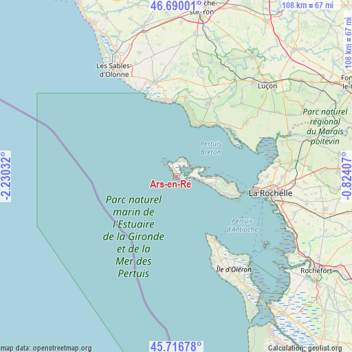
Ars-en-Ré GPS coordinates[2]
46° 12' 19.98" North, 1° 31' 37.92" West
| Map corner | latitude | longitude |
|---|---|---|
| Upper-left | 46.69001°, | -2.23032° |
| Center: | 46.20555°, | -1.5272° |
| Lower-right: | 45.71678°, | -0.82407° |
| Map W x H: | 108.2×108.2 km | = 67.2×67.2mi |
| max Lat: | 51.07786° ⇑63.5% North |
| Ars-en-Ré: | 46.20555° |
| min Lat: | ⇓36.5% South 41.3874° |
| min Long | Ars-en-Ré | max Long |
| -5.08615° | -1.5272° | 9.52242° |
| W 7.5%⇐ | ⇒92.5% E |
Elevation
Elevation of Ars-en-Ré is 4 m = 13 ft, and this is 189.7 m = 622 ft below average elevation for this country.
| Max E: |
2333 m = 7654 ft | 99.6% |
| Avg. | 193.7 m = 635 ft | |
| Ars-en-Ré | 4 m = 13 ft | |
Min E: |
-1 m = -3 ft | 0.4% |
See also: France elevation on elevation.city.
Geographical zone
Ars-en-Ré is located in North temperate zone (between Tropic of Cancer and the Arctic Circle). Distance of this North polar circle is 2263.6 km =1406.5 mi to North.| Distance of | km | miles | from Ars-en-Ré |
|---|---|---|---|
| North Pole | 4869.5 | 3025.8 | to North |
| Arctic Circle | 2263.6 | 1406.5 | to North |
| Tropic Cancer | 2531.7 | 1573.1 | to South |
| Equator | 5137.6 | 3192.4 | to South |


Nearby cities:
15 places around Ars-en-Ré: (largest is in red/bold)
• Jard-sur-Mer
23.5 km =14.6 mi,  350°
350°
• La Couarde-sur-Mer
8 km =5 mi,  99°
99°
• La Faute-sur-Mer
21 km =13 mi,  47°
47°
• La Flotte
15.4 km =9.6 mi, 97°
• La Tranche-sur-Mer
16.8 km =10.4 mi,  24°
24°
• Le Bois-Plage-en-Ré
10.6 km =6.6 mi, 101°
• Les Portes-en-Ré
5.4 km =3.4 mi, 22°
• Loix
7.6 km =4.7 mi,  71°
71°
• Longeville-sur-Mer
23.6 km =14.7 mi,  5°
5°
• Rivedoux-Plage
20.4 km =12.7 mi, 104°
• Saint-Clément-des-Baleines
2.6 km =1.6 mi,  331°
331°
• Saint-Denis-d’Oléron
22.2 km =13.8 mi,  148°
148°
• Saint-Martin-de-Ré
12.3 km =7.6 mi,  91°
91°
• Saint-Vincent-sur-Jard
23.6 km =14.7 mi, 354°
• Sainte-Marie-de-Ré
17.5 km =10.9 mi,  109°
109°
Sources, notices
• [Note1] Compared only with cities in France existing in our database
• [Src1] Map data: © OpenStreetMap contributors (CC-BY-SA)
• [Src2] Other city data from geonames.org with taken over terms of usage.
• [Src3] Geographical zone / Annual Mean Temperature by Robert A. Rohde @ Wikipedia
