Lafeuillade-en-Vézie geodata
Lafeuillade-en-Vézie (Auvergne-Rhône-Alpes) is a populated place; located in France in Europe/Paris (GMT+2) time zone. With population of 544 people, there are 14318 cities with bigger population in this country. Compared to other cities in France, 81.5% of cities are located further ↑North; 50% of cities are located further ←West and 97.1% of cities have lower elevation than Lafeuillade-en-Vézie. Note1
Administrative division(s):
- Level 1: Auvergne-Rhône-Alpes
- Level 2: Cantal
- Level 3: Aurillac
- Level 4: Lafeuillade-en-Vézie


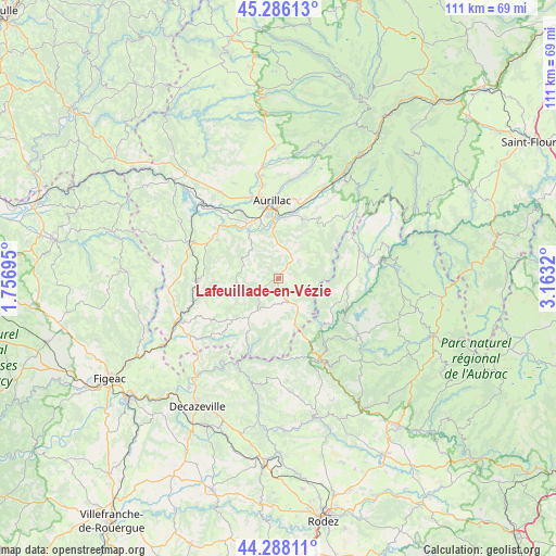
Lafeuillade-en-Vézie GPS coordinates[2]
44° 47' 21.408" North, 2° 27' 36.252" East
| Map corner | latitude | longitude |
|---|---|---|
| Upper-left | 45.28613°, | 1.75695° |
| Center: | 44.78928°, | 2.46007° |
| Lower-right: | 44.28811°, | 3.1632° |
| Map W x H: | 111×111 km | = 69×69mi |
| max Lat: | 51.07786° ⇑81.5% North |
| Lafeuillade-en-Vézie: | 44.78928° |
| min Lat: | ⇓18.5% South 41.3874° |
| min Long | Lafeuillade-en- | max Long |
| -5.08615° | 2.46007° | 9.52242° |
| W 50%⇐ | ⇒50% E |
Elevation
Elevation of Lafeuillade-en-Vézie is 732 m = 2402 ft, and this is 538.3 m = 1766 ft above average elevation for this country.
| Max E: |
2333 m = 7654 ft | 2.9% |
| Lafeuillade-en-Vézie | 732 m 2402 ft | |
| Avg. | 193.7 m = 635 ft | |
Min E: |
-1 m = -3 ft | 97.1% |
See also: France elevation on elevation.city.
Geographical zone
Lafeuillade-en-Vézie is located in North temperate zone (between Tropic of Cancer and the Arctic Circle). Distance of this Northern Tropic circle is 2374.2 km =1475.3 mi to South.| Distance of | km | miles | from Lafeuillade-en-Vézie |
|---|---|---|---|
| North Pole | 5027 | 3123.6 | to North |
| Arctic Circle | 2421.1 | 1504.4 | to North |
| Tropic Cancer | 2374.2 | 1475.3 | to South |
| Equator | 4980.1 | 3094.5 | to South |


Nearby cities:
15 places around Lafeuillade-en-Vézie: (largest is in red/bold)
• Arpajon-sur-Cère
12.7 km =7.9 mi,  358°
358°
• Aurillac
15.2 km =9.4 mi,  353°
353°
• Boisset
16.3 km =10.1 mi,  267°
267°
• Cassaniouze
12.5 km =7.8 mi,  209°
209°
• Giou-de-Mamou
16.4 km =10.2 mi,  14°
14°
• Lacroix-Barrez
14 km =8.7 mi,  94°
94°
• Marcolès
8.5 km =5.3 mi,  264°
264°
• Montsalvy
9.7 km =6 mi,  160°
160°
• Mur-de-Barrez
17 km =10.6 mi,  69°
69°
• Prunet
3.5 km =2.2 mi,  4°
4°
• Roannes-Saint-Mary
9.3 km =5.8 mi,  323°
323°
• Saint-Mamet-la-Salvetat
14.3 km =8.9 mi,  302°
302°
• Sansac-de-Marmiesse
13.7 km =8.5 mi, 319°
• Taussac
15 km =9.3 mi, 72°
• Ytrac
15.7 km =9.8 mi,  330°
330°
Sources, notices
• [Note1] Compared only with cities in France existing in our database
• [Src1] Map data: © OpenStreetMap contributors (CC-BY-SA)
• [Src2] Other city data from geonames.org with taken over terms of usage.
• [Src3] Geographical zone / Annual Mean Temperature by Robert A. Rohde @ Wikipedia
