Annay geodata
Annay (Hauts-de-France) is a populated place; located in France in Europe/Paris (GMT+2) time zone. With population of 4,797 people, there are 2071 cities with bigger population in this country. Compared to other cities in France, 97% of cities are located further ↓South; 56.1% of cities are located further ←West and 89.1% of cities have higher elevation than Annay. Note1
Administrative division(s):
- Level 1: Hauts-de-France
- Level 2: Pas-de-Calais
- Level 3: Arrondissement de Lens
- Level 4: Annay


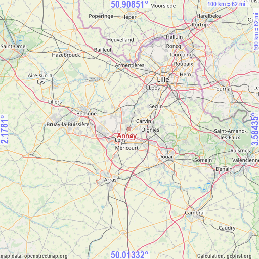
Annay GPS coordinates[2]
50° 27' 46.908" North, 2° 52' 52.392" East
| Map corner | latitude | longitude |
|---|---|---|
| Upper-left | 50.90851°, | 2.1781° |
| Center: | 50.46303°, | 2.88122° |
| Lower-right: | 50.01332°, | 3.58435° |
| Map W x H: | 99.5×99.5 km | = 61.8×61.8mi |
| max Lat: | 51.07786° ⇑3% North |
| Annay: | 50.46303° |
| min Lat: | ⇓97% South 41.3874° |
| min Long | Annay | max Long |
| -5.08615° | 2.88122° | 9.52242° |
| W 56.1%⇐ | ⇒43.9% E |
Elevation
Elevation of Annay is 32 m = 105 ft, and this is 161.7 m = 531 ft below average elevation for this country.
| Max E: |
2333 m = 7654 ft | 89.1% |
| Avg. | 193.7 m = 635 ft | |
| Annay | 32 m = 105 ft | |
Min E: |
-1 m = -3 ft | 10.9% |
See also: France elevation on elevation.city.
Geographical zone
Annay is located in North temperate zone (between Tropic of Cancer and the Arctic Circle). Distance of this North polar circle is 1790.2 km =1112.4 mi to North.| Distance of | km | miles | from Annay |
|---|---|---|---|
| North Pole | 4396.1 | 2731.6 | to North |
| Arctic Circle | 1790.2 | 1112.4 | to North |
| Tropic Cancer | 3005 | 1867.2 | to South |
| Equator | 5611 | 3486.5 | to South |


Nearby cities:
15 places around Annay: (largest is in red/bold)
• Billy-Montigny
5.3 km =3.3 mi,  163°
163°
• Courrières
4.7 km =2.9 mi,  98°
98°
• Estevelles
2.5 km =1.6 mi,  52°
52°
• Fouquières-lès-Lens
4.5 km =2.8 mi,  149°
149°
• Harnes
2.5 km =1.6 mi,  137°
137°
• Hulluch
5.7 km =3.5 mi,  301°
301°
• Lens
5 km =3.1 mi,  228°
228°
• Loison-sous-Lens
3.4 km =2.1 mi,  215°
215°
• Meurchin
4 km =2.5 mi,  12°
12°
• Noyelles-sous-Lens
3.6 km =2.2 mi,  190°
190°
• Pont-à-Vendin
1.3 km =0.8 mi,  24°
24°
• Sallaumines
5.2 km =3.2 mi,  195°
195°
• Vendin-le-Vieil
1.6 km =1 mi,  319°
319°
• Wingles
3.9 km =2.4 mi,  331°
331°
• Épinoy
5 km =3.1 mi,  63°
63°
Sources, notices
• [Note1] Compared only with cities in France existing in our database
• [Src1] Map data: © OpenStreetMap contributors (CC-BY-SA)
• [Src2] Other city data from geonames.org with taken over terms of usage.
• [Src3] Geographical zone / Annual Mean Temperature by Robert A. Rohde @ Wikipedia
