Noyelles-sous-Lens geodata
Noyelles-sous-Lens (Hauts-de-France) is a populated place; located in France in Europe/Paris (GMT+2) time zone. With population of 7,467 people, there are 1303 cities with bigger population in this country. Compared to other cities in France, 96.7% of cities are located further ↓South; 56% of cities are located further ←West and 91.6% of cities have higher elevation than Noyelles-sous-Lens. Note1
Administrative division(s):
- Level 1: Hauts-de-France
- Level 2: Pas-de-Calais
- Level 3: Arrondissement de Lens
- Level 4: Noyelles-sous-Lens


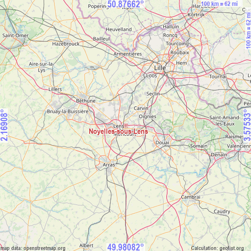
Noyelles-sous-Lens GPS coordinates[2]
50° 25' 51.024" North, 2° 52' 19.956" East
| Map corner | latitude | longitude |
|---|---|---|
| Upper-left | 50.87662°, | 2.16908° |
| Center: | 50.43084°, | 2.87221° |
| Lower-right: | 49.98082°, | 3.57533° |
| Map W x H: | 99.6×99.6 km | = 61.9×61.9mi |
| max Lat: | 51.07786° ⇑3.3% North |
| Noyelles-sous-Lens: | 50.43084° |
| min Lat: | ⇓96.7% South 41.3874° |
| min Long | Noyelles-sous-L | max Long |
| -5.08615° | 2.87221° | 9.52242° |
| W 56%⇐ | ⇒44% E |
Elevation
Elevation of Noyelles-sous-Lens is 26 m = 85 ft, and this is 167.7 m = 550 ft below average elevation for this country.
| Max E: |
2333 m = 7654 ft | 91.6% |
| Avg. | 193.7 m = 635 ft | |
| Noyelles-sous-Lens | 26 m = 85 ft | |
Min E: |
-1 m = -3 ft | 8.4% |
See also: France elevation on elevation.city.
Geographical zone
Noyelles-sous-Lens is located in North temperate zone (between Tropic of Cancer and the Arctic Circle). Distance of this North polar circle is 1793.8 km =1114.6 mi to North.| Distance of | km | miles | from Noyelles-sous-Lens |
|---|---|---|---|
| North Pole | 4399.7 | 2733.8 | to North |
| Arctic Circle | 1793.8 | 1114.6 | to North |
| Tropic Cancer | 3001.5 | 1865 | to South |
| Equator | 5607.4 | 3484.3 | to South |


Nearby cities:
15 places around Noyelles-sous-Lens: (largest is in red/bold)
• Acheville
5.3 km =3.3 mi,  171°
171°
• Annay
3.6 km =2.2 mi,  10°
10°
• Avion
3.7 km =2.3 mi,  232°
232°
• Billy-Montigny
2.7 km =1.7 mi,  125°
125°
• Fouquières-lès-Lens
2.9 km =1.8 mi,  95°
95°
• Harnes
2.9 km =1.8 mi,  53°
53°
• Lens
3.1 km =1.9 mi,  274°
274°
• Loison-sous-Lens
1.6 km =1 mi,  300°
300°
• Montigny-en-Gohelle
4.8 km =3 mi, 97°
• Méricourt
3.4 km =2.1 mi,  191°
191°
• Pont-à-Vendin
4.9 km =3 mi, 13°
• Rouvroy
4.8 km =3 mi,  152°
152°
• Sallaumines
1.7 km =1.1 mi,  206°
206°
• Vendin-le-Vieil
4.8 km =3 mi,  355°
355°
• Éleu-dit-Leauwette
4.5 km =2.8 mi,  256°
256°
Sources, notices
• [Note1] Compared only with cities in France existing in our database
• [Src1] Map data: © OpenStreetMap contributors (CC-BY-SA)
• [Src2] Other city data from geonames.org with taken over terms of usage.
• [Src3] Geographical zone / Annual Mean Temperature by Robert A. Rohde @ Wikipedia
