Albitreccia geodata
Albitreccia (Corsica) is a populated place; located in France in Europe/Paris (GMT+2) time zone. With population of 1,322 people, there are 6932 cities with bigger population in this country. Compared to other cities in France, 99.9% of cities are located further ↑North; 99.6% of cities are located further ←West and 92% of cities have lower elevation than Albitreccia. Note1
Administrative division(s):
- Level 1: Corsica
- Level 2: Département de la Corse-du-Sud
- Level 3: Arrondissement d’Ajaccio
- Level 4: Albitreccia


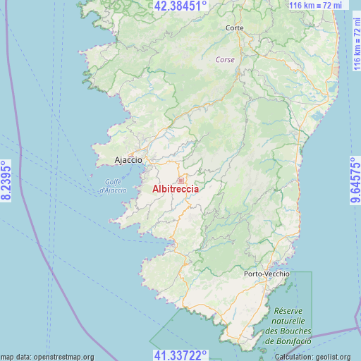
Albitreccia GPS coordinates[2]
41° 51' 46.836" North, 8° 56' 33.432" East
| Map corner | latitude | longitude |
|---|---|---|
| Upper-left | 42.38451°, | 8.2395° |
| Center: | 41.86301°, | 8.94262° |
| Lower-right: | 41.33722°, | 9.64575° |
| Map W x H: | 116.4×116.4 km | = 72.3×72.3mi |
| max Lat: | 51.07786° ⇑99.9% North |
| Albitreccia: | 41.86301° |
| min Lat: | ⇓0.1% South 41.3874° |
| min Long | Albitreccia | max Long |
| -5.08615° | 8.94262° | 9.52242° |
| W 99.6%⇐ | ⇒0.40000000000001% E |
Elevation
Elevation of Albitreccia is 477 m = 1565 ft, and this is 283.3 m = 929 ft above average elevation for this country.
| Max E: |
2333 m = 7654 ft | 8% |
| Albitreccia | 477 m 1565 ft | |
| Avg. | 193.7 m = 635 ft | |
Min E: |
-1 m = -3 ft | 92% |
See also: France elevation on elevation.city.
Geographical zone
Albitreccia is located in North temperate zone (between Tropic of Cancer and the Arctic Circle). Distance of this Northern Tropic circle is 2048.8 km =1273.1 mi to South.| Distance of | km | miles | from Albitreccia |
|---|---|---|---|
| North Pole | 5352.3 | 3325.8 | to North |
| Arctic Circle | 2746.4 | 1706.5 | to North |
| Tropic Cancer | 2048.8 | 1273.1 | to South |
| Equator | 4654.7 | 2892.3 | to South |


Nearby cities:
15 places around Albitreccia: (largest is in red/bold)
• Afa
18 km =11.2 mi,  318°
318°
• Ajaccio
18 km =11.2 mi,  290°
290°
• Alata
20.8 km =12.9 mi,  307°
307°
• Appietto
22.1 km =13.7 mi, 319°
• Bastelica
18.1 km =11.2 mi,  30°
30°
• Cauro
6.5 km =4 mi,  339°
339°
• Coti-Chiavari
17.4 km =10.8 mi,  234°
234°
• Cuttoli-Corticchiato
13.5 km =8.4 mi,  350°
350°
• Grosseto-Prugna
2 km =1.2 mi,  63°
63°
• Olmeto
16.3 km =10.1 mi,  187°
187°
• Peri
15.7 km =9.8 mi, 353°
• Petreto
9.4 km =5.8 mi,  160°
160°
• Pietrosella
8.6 km =5.3 mi,  249°
249°
• Propriano
21 km =13 mi, 188°
• Sarrola
20.2 km =12.6 mi, 335°
Sources, notices
• [Note1] Compared only with cities in France existing in our database
• [Src1] Map data: © OpenStreetMap contributors (CC-BY-SA)
• [Src2] Other city data from geonames.org with taken over terms of usage.
• [Src3] Geographical zone / Annual Mean Temperature by Robert A. Rohde @ Wikipedia
