Ailly-sur-Noye geodata
Ailly-sur-Noye (Hauts-de-France) is a populated place; located in France in Europe/Paris (GMT+2) time zone. With population of 2,691 people, there are 3626 cities with bigger population in this country. Compared to other cities in France, 92% of cities are located further ↓South; 51.6% of cities are located further →East and 76.2% of cities have higher elevation than Ailly-sur-Noye. Note1
Administrative division(s):
- Level 1: Hauts-de-France
- Level 2: Somme
- Level 3: Arrondissement de Montdidier
- Level 4: Ailly-sur-Noye


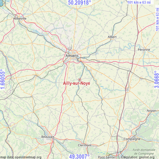
Ailly-sur-Noye GPS coordinates[2]
49° 45' 25.452" North, 2° 21' 49.212" East
| Map corner | latitude | longitude |
|---|---|---|
| Upper-left | 50.20918°, | 1.66055° |
| Center: | 49.75707°, | 2.36367° |
| Lower-right: | 49.3007°, | 3.0668° |
| Map W x H: | 101×101 km | = 62.8×62.8mi |
| max Lat: | 51.07786° ⇑8% North |
| Ailly-sur-Noye: | 49.75707° |
| min Lat: | ⇓92% South 41.3874° |
| min Long | Ailly-sur-Noye | max Long |
| -5.08615° | 2.36367° | 9.52242° |
| W 48.4%⇐ | ⇒51.6% E |
Elevation
Elevation of Ailly-sur-Noye is 64 m = 210 ft, and this is 129.7 m = 426 ft below average elevation for this country.
| Max E: |
2333 m = 7654 ft | 76.2% |
| Avg. | 193.7 m = 635 ft | |
| Ailly-sur-Noye | 64 m = 210 ft | |
Min E: |
-1 m = -3 ft | 23.8% |
See also: France elevation on elevation.city.
Geographical zone
Ailly-sur-Noye is located in North temperate zone (between Tropic of Cancer and the Arctic Circle). Distance of this North polar circle is 1868.7 km =1161.2 mi to North.| Distance of | km | miles | from Ailly-sur-Noye |
|---|---|---|---|
| North Pole | 4474.6 | 2780.4 | to North |
| Arctic Circle | 1868.7 | 1161.2 | to North |
| Tropic Cancer | 2926.5 | 1818.4 | to South |
| Equator | 5532.5 | 3437.7 | to South |


Nearby cities:
15 places around Ailly-sur-Noye: (largest is in red/bold)
• Bonneuil-les-Eaux
12.6 km =7.8 mi,  226°
226°
• Boves
10.2 km =6.3 mi,  13°
13°
• Cagny
11.8 km =7.3 mi,  352°
352°
• Chaussoy-Epagny
3.4 km =2.1 mi,  219°
219°
• Cottenchy
6 km =3.7 mi, 14°
• Dury
12 km =7.5 mi,  326°
326°
• Moreuil
8.8 km =5.5 mi,  77°
77°
• Oresmaux
6.8 km =4.2 mi,  280°
280°
• Paillart
10.4 km =6.5 mi,  195°
195°
• Plachy-Buyon
12.3 km =7.6 mi,  301°
301°
• Rumigny
8.3 km =5.2 mi,  313°
313°
• Sains-en-Amiénois
7.4 km =4.6 mi, 334°
• Saint-Fuscien
9.6 km =6 mi,  338°
338°
• Saint-Sauflieu
8.7 km =5.4 mi,  294°
294°
• Vers-sur-Selles
12.6 km =7.8 mi, 312°
Sources, notices
• [Note1] Compared only with cities in France existing in our database
• [Src1] Map data: © OpenStreetMap contributors (CC-BY-SA)
• [Src2] Other city data from geonames.org with taken over terms of usage.
• [Src3] Geographical zone / Annual Mean Temperature by Robert A. Rohde @ Wikipedia
