Abos geodata
Abos (Nouvelle-Aquitaine) is a populated place; located in France in Europe/Paris (GMT+2) time zone. With population of 519 people, there are 14840 cities with bigger population in this country. Compared to other cities in France, 94.9% of cities are located further ↑North; 84.1% of cities are located further →East and 53.8% of cities have higher elevation than Abos. Note1
Administrative division(s):
- Level 1: Nouvelle-Aquitaine
- Level 2: Département des Pyrénées-Atlantiques
- Level 3: Arrondissement de Pau
- Level 4: Abos


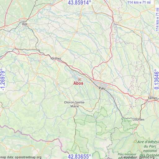
Abos GPS coordinates[2]
43° 21' 0" North, 0° 34' 0.012" West
| Map corner | latitude | longitude |
|---|---|---|
| Upper-left | 43.85914°, | -1.26979° |
| Center: | 43.35°, | -0.56667° |
| Lower-right: | 42.83655°, | 0.13646° |
| Map W x H: | 113.7×113.7 km | = 70.6×70.6mi |
| max Lat: | 51.07786° ⇑94.9% North |
| Abos: | 43.35° |
| min Lat: | ⇓5.1% South 41.3874° |
| min Long | Abos | max Long |
| -5.08615° | -0.56667° | 9.52242° |
| W 15.9%⇐ | ⇒84.1% E |
Elevation
Elevation of Abos is 120 m = 394 ft, and this is 73.7 m = 242 ft below average elevation for this country.
| Max E: |
2333 m = 7654 ft | 53.8% |
| Avg. | 193.7 m = 635 ft | |
| Abos | 120 m = 394 ft | |
Min E: |
-1 m = -3 ft | 46.2% |
See also: France elevation on elevation.city.
Geographical zone
Abos is located in North temperate zone (between Tropic of Cancer and the Arctic Circle). Distance of this Northern Tropic circle is 2214.1 km =1375.8 mi to South.| Distance of | km | miles | from Abos |
|---|---|---|---|
| North Pole | 5187 | 3223.1 | to North |
| Arctic Circle | 2581.1 | 1603.8 | to North |
| Tropic Cancer | 2214.1 | 1375.8 | to South |
| Equator | 4820.1 | 2995.1 | to South |


Nearby cities:
15 places around Abos: (largest is in red/bold)
• Arbus
5.7 km =3.5 mi,  108°
108°
• Artiguelouve
8.9 km =5.5 mi, 114°
• Artix
5.2 km =3.2 mi,  354°
354°
• Aussevielle
6.7 km =4.2 mi,  90°
90°
• Bougarber
9.8 km =6.1 mi,  55°
55°
• Denguin
5.7 km =3.5 mi,  71°
71°
• Lacq
9.2 km =5.7 mi,  323°
323°
• Lagor
7.7 km =4.8 mi,  298°
298°
• Lahourcade
4 km =2.5 mi,  270°
270°
• Lucq-de-Béarn
9.8 km =6.1 mi,  235°
235°
• Monein
2.3 km =1.4 mi,  216°
216°
• Mourenx
4.6 km =2.9 mi, 323°
• Pardies
2.3 km =1.4 mi, 323°
• Poey-de-Lescar
8.1 km =5 mi, 90°
• Siros
6.9 km =4.3 mi,  96°
96°
Sources, notices
• [Note1] Compared only with cities in France existing in our database
• [Src1] Map data: © OpenStreetMap contributors (CC-BY-SA)
• [Src2] Other city data from geonames.org with taken over terms of usage.
• [Src3] Geographical zone / Annual Mean Temperature by Robert A. Rohde @ Wikipedia
