Lacq geodata
Lacq (Nouvelle-Aquitaine) is a populated place; located in France in Europe/Paris (GMT+2) time zone. With population of 706 people, there are 11718 cities with bigger population in this country. Compared to other cities in France, 94.1% of cities are located further ↑North; 84.8% of cities are located further →East and 62% of cities have higher elevation than Lacq. Note1
Administrative division(s):
- Level 1: Nouvelle-Aquitaine
- Level 2: Département des Pyrénées-Atlantiques
- Level 3: Arrondissement de Pau
- Level 4: Lacq


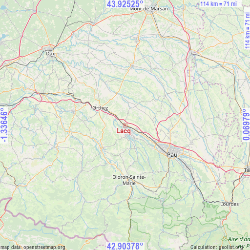
Lacq GPS coordinates[2]
43° 25' 0.012" North, 0° 37' 59.988" West
| Map corner | latitude | longitude |
|---|---|---|
| Upper-left | 43.92525°, | -1.33646° |
| Center: | 43.41667°, | -0.63333° |
| Lower-right: | 42.90378°, | 0.06979° |
| Map W x H: | 113.6×113.6 km | = 70.6×70.6mi |
| max Lat: | 51.07786° ⇑94.1% North |
| Lacq: | 43.41667° |
| min Lat: | ⇓5.9% South 41.3874° |
| min Long | Lacq | max Long |
| -5.08615° | -0.63333° | 9.52242° |
| W 15.2%⇐ | ⇒84.8% E |
Elevation
Elevation of Lacq is 97 m = 318 ft, and this is 96.7 m = 317 ft below average elevation for this country.
| Max E: |
2333 m = 7654 ft | 62% |
| Avg. | 193.7 m = 635 ft | |
| Lacq | 97 m = 318 ft | |
Min E: |
-1 m = -3 ft | 38% |
See also: France elevation on elevation.city.
Geographical zone
Lacq is located in North temperate zone (between Tropic of Cancer and the Arctic Circle). Distance of this Northern Tropic circle is 2221.6 km =1380.4 mi to South.| Distance of | km | miles | from Lacq |
|---|---|---|---|
| North Pole | 5179.6 | 3218.5 | to North |
| Arctic Circle | 2573.7 | 1599.2 | to North |
| Tropic Cancer | 2221.6 | 1380.4 | to South |
| Equator | 4827.5 | 2999.7 | to South |


Nearby cities:
15 places around Lacq: (largest is in red/bold)
• Abos
9.2 km =5.7 mi,  143°
143°
• Argagnon
5.5 km =3.4 mi,  312°
312°
• Arthez-de-Béarn
6.2 km =3.9 mi,  25°
25°
• Artix
5.4 km =3.4 mi,  114°
114°
• Biron
9.8 km =6.1 mi,  301°
301°
• Castétis
8.7 km =5.4 mi, 309°
• Denguin
12.1 km =7.5 mi,  117°
117°
• Lagor
3.9 km =2.4 mi,  199°
199°
• Lahourcade
7.5 km =4.7 mi,  169°
169°
• Lucq-de-Béarn
13.2 km =8.2 mi,  191°
191°
• Maslacq
5.7 km =3.5 mi,  288°
288°
• Monein
10.1 km =6.3 mi,  156°
156°
• Mont
2.3 km =1.4 mi,  323°
323°
• Mourenx
4.6 km =2.9 mi, 144°
• Pardies
6.9 km =4.3 mi, 143°
Sources, notices
• [Note1] Compared only with cities in France existing in our database
• [Src1] Map data: © OpenStreetMap contributors (CC-BY-SA)
• [Src2] Other city data from geonames.org with taken over terms of usage.
• [Src3] Geographical zone / Annual Mean Temperature by Robert A. Rohde @ Wikipedia
