Lugon-et-l'Île-du-Carnay geodata
Lugon-et-l'Île-du-Carnay (Nouvelle-Aquitaine) is a populated place; located in France in Europe/Paris (GMT+2) time zone. With population of 1,060 people, there are 8398 cities with bigger population in this country. Compared to other cities in France, 80% of cities are located further ↑North; 81.3% of cities are located further →East and 81.8% of cities have higher elevation than Lugon-et-l'Île-du-Carnay. Note1
Administrative division(s):
- Level 1: Nouvelle-Aquitaine
- Level 2: Gironde
- Level 3: Arrondissement de Libourne
- Level 4: Lugon-et-l'Île-du-Carnay
Current local time in Lugon-et-l'Île-du-Carnay:
06:01 AM, WednesdayDifference from your time zone: hours


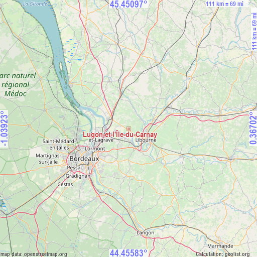
Lugon-et-l'Île-du-Carnay GPS coordinates[2]
44° 57' 20.016" North, 0° 20' 9.996" West
| Map corner | latitude | longitude |
|---|---|---|
| Upper-left | 45.45097°, | -1.03923° |
| Center: | 44.95556°, | -0.33611° |
| Lower-right: | 44.45583°, | 0.36702° |
| Map W x H: | 110.6×110.6 km | = 68.7×68.7mi |
| max Lat: | 51.07786° ⇑80% North |
| Lugon-et-l'Île-du-Carnay: | 44.95556° |
| min Lat: | ⇓20% South 41.3874° |
| min Long | Lugon-et-l'Île | max Long |
| -5.08615° | -0.33611° | 9.52242° |
| W 18.7%⇐ | ⇒81.3% E |
Elevation
Elevation of Lugon-et-l'Île-du-Carnay is 50 m = 164 ft, and this is 143.7 m = 471 ft below average elevation for this country.
| Max E: |
2333 m = 7654 ft | 81.8% |
| Avg. | 193.7 m = 635 ft | |
| Lugon-et-l'Île-du-Carnay | 50 m = 164 ft | |
Min E: |
-1 m = -3 ft | 18.2% |
See also: France elevation on elevation.city.
Geographical zone
Lugon-et-l'Île-du-Carnay is located in North temperate zone (between Tropic of Cancer and the Arctic Circle). Distance of this Northern Tropic circle is 2392.7 km =1486.8 mi to South.| Distance of | km | miles | from Lugon-et-l'Île-du-Carnay |
|---|---|---|---|
| North Pole | 5008.5 | 3112.1 | to North |
| Arctic Circle | 2402.6 | 1492.9 | to North |
| Tropic Cancer | 2392.7 | 1486.8 | to South |
| Equator | 4998.6 | 3106 | to South |


Nearby cities:
15 places around Lugon-et-l'Île-du-Carnay: (largest is in red/bold)
• Asques
5.9 km =3.7 mi,  266°
266°
• Cadillac-en-Fronsadais
3.1 km =1.9 mi,  294°
294°
• Fronsac
7 km =4.3 mi,  128°
128°
• Galgon
6.3 km =3.9 mi,  60°
60°
• Izon
4.1 km =2.5 mi,  211°
211°
• La Lande-de-Fronsac
4.4 km =2.7 mi,  308°
308°
• Périssac
7 km =4.3 mi,  12°
12°
• Saint-Genès-de-Fronsac
7.9 km =4.9 mi,  347°
347°
• Saint-Michel-de-Fronsac
2.9 km =1.8 mi,  148°
148°
• Saint-Romain-la-Virvée
5.1 km =3.2 mi,  282°
282°
• Saint-Sulpice-et-Cameyrac
6.5 km =4 mi,  221°
221°
• Salignac
7.5 km =4.7 mi,  333°
333°
• Vayres
6.4 km =4 mi,  166°
166°
• Villegouge
3.1 km =1.9 mi,  66°
66°
• Vérac
3.1 km =1.9 mi,  4°
4°
Sources, notices
• [Note1] Compared only with cities in France existing in our database
• [Src1] Map data: © OpenStreetMap contributors (CC-BY-SA)
• [Src2] Other city data from geonames.org with taken over terms of usage.
• [Src3] Geographical zone / Annual Mean Temperature by Robert A. Rohde @ Wikipedia
