Ouessant geodata
Ouessant (Brittany) is a populated place; located in France in Europe/Paris (GMT+2) time zone. With population of 883 people, there are 9798 cities with bigger population in this country. Compared to other cities in France, 67.5% of cities are located further ↓South; 100% of cities are located further →East and 96% of cities have higher elevation than Ouessant. Note1
Administrative division(s):
- Level 1: Brittany
- Level 2: Département du Finistère
- Level 3: Arrondissement de Brest
- Level 4: Ouessant


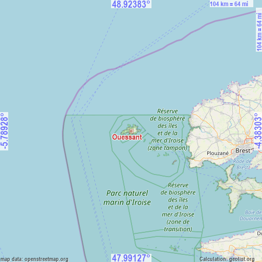
Ouessant GPS coordinates[2]
48° 27' 34.884" North, 5° 5' 10.14" West
| Map corner | latitude | longitude |
|---|---|---|
| Upper-left | 48.92383°, | -5.78928° |
| Center: | 48.45969°, | -5.08615° |
| Lower-right: | 47.99127°, | -4.38303° |
| Map W x H: | 103.7×103.7 km | = 64.4×64.4mi |
| max Lat: | 51.07786° ⇑32.5% North |
| Ouessant: | 48.45969° |
| min Lat: | ⇓67.5% South 41.3874° |
| min Long | Ouessant | max Long |
| -5.08615° | -5.08615° | 9.52242° |
| W 0%⇐ | ⇒100% E |
Elevation
Elevation of Ouessant is 14 m = 46 ft, and this is 179.7 m = 590 ft below average elevation for this country.
| Max E: |
2333 m = 7654 ft | 96% |
| Avg. | 193.7 m = 635 ft | |
| Ouessant | 14 m = 46 ft | |
Min E: |
-1 m = -3 ft | 4% |
See also: France elevation on elevation.city.
Geographical zone
Ouessant is located in North temperate zone (between Tropic of Cancer and the Arctic Circle). Distance of this North polar circle is 2013 km =1250.8 mi to North.| Distance of | km | miles | from Ouessant |
|---|---|---|---|
| North Pole | 4618.8 | 2870 | to North |
| Arctic Circle | 2013 | 1250.8 | to North |
| Tropic Cancer | 2782.3 | 1728.8 | to South |
| Equator | 5388.2 | 3348.1 | to South |


Nearby cities:
15 places around Ouessant: (largest is in red/bold)
• Brélès
27.5 km =17.1 mi,  86°
86°
• Lampaul-Plouarzel
24.1 km =15 mi, 93°
• Lampaul-Ploudalmézeau
33.7 km =20.9 mi,  70°
70°
• Landunvez
27.9 km =17.3 mi, 72°
• Lanildut
24.9 km =15.5 mi,  83°
83°
• Lanrivoaré
33 km =20.5 mi, 87°
• Le Conquet
25.8 km =16 mi,  115°
115°
• Plouarzel
26.2 km =16.3 mi,  96°
96°
• Ploudalmézeau
33.2 km =20.6 mi, 75°
• Plougonvelin
30.2 km =18.8 mi, 116°
• Plouguin
36.7 km =22.8 mi, 77°
• Ploumoguer
28.1 km =17.5 mi, 103°
• Plouzané
35.7 km =22.2 mi, 103°
• Porspoder
24 km =14.9 mi, 79°
• Saint-Renan
34.7 km =21.6 mi, 94°
Sources, notices
• [Note1] Compared only with cities in France existing in our database
• [Src1] Map data: © OpenStreetMap contributors (CC-BY-SA)
• [Src2] Other city data from geonames.org with taken over terms of usage.
• [Src3] Geographical zone / Annual Mean Temperature by Robert A. Rohde @ Wikipedia
