Wembley geodata
Wembley (England) is a seat of a third-order administrative division; located in United Kingdom in Europe/London (GMT+1) time zone. With population of 90,045 people, there are 111 cities with bigger population in this country. Compared to other cities in United Kingdom, 76% of cities are located further ↑North; 81.2% of cities are located further ←West and 60.2% of cities have higher elevation than Wembley. Note1


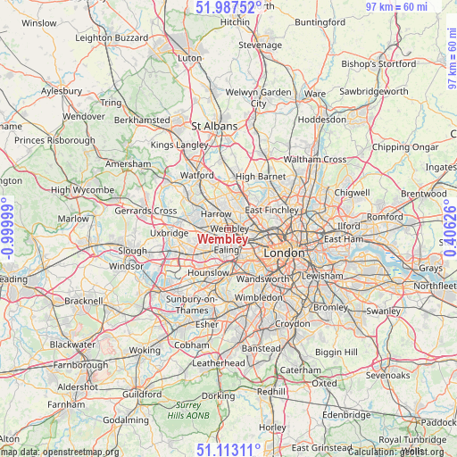
Wembley GPS coordinates[2]
51° 33' 8.712" North, 0° 17' 48.696" West
| Map corner | latitude | longitude |
|---|---|---|
| Upper-left | 51.98752°, | -0.99999° |
| Center: | 51.55242°, | -0.29686° |
| Lower-right: | 51.11311°, | 0.40626° |
| Map W x H: | 97.2×97.2 km | = 60.4×60.4mi |
| max Lat: | 60.39635° ⇑76% North |
| Wembley: | 51.55242° |
| min Lat: | ⇓24% South 34.60088° |
| min Long | Wembley | max Long |
| -7.64133° | -0.29686° | 32.95536° |
| W 81.2%⇐ | ⇒18.8% E |
Elevation
Elevation of Wembley is 46 m = 151 ft, and this is 26.9 m = 88 ft below average elevation for this country.
| Max E: |
515 m = 1690 ft | 60.2% |
| Avg. | 72.9 m = 239 ft | |
| Wembley | 46 m = 151 ft | |
Min E: |
-30 m = -98 ft | 39.8% |
See also: Wembley elevation on elevation.city.
Geographical zone
Wembley is located in North temperate zone (between Tropic of Cancer and the Arctic Circle). Distance of this North polar circle is 1669.1 km =1037.1 mi to North.| Distance of | km | miles | from Wembley |
|---|---|---|---|
| North Pole | 4275 | 2656.4 | to North |
| Arctic Circle | 1669.1 | 1037.1 | to North |
| Tropic Cancer | 3126.2 | 1942.5 | to South |
| Equator | 5732.1 | 3561.8 | to South |


Nearby cities:
15 places around Wembley: (largest is in red/bold)
• Acton
5 km =3.1 mi,  163°
163°
• Brent
0.4 km =0.2 mi,  280°
280°
• Brentford
7.4 km =4.6 mi,  186°
186°
• Ealing
4.5 km =2.8 mi,  184°
184°
• Ealing Broadway
4.1 km =2.5 mi, 183°
• Edgware
6.9 km =4.3 mi,  12°
12°
• Greenford
4.8 km =3 mi,  236°
236°
• Greenhill
4.5 km =2.8 mi,  320°
320°
• Harrow
3.8 km =2.4 mi, 319°
• Harrow on the Hill
3.3 km =2.1 mi,  309°
309°
• Hendon
7.7 km =4.8 mi,  46°
46°
• Northolt
4.9 km =3 mi,  264°
264°
• Pinner
7.5 km =4.7 mi, 307°
• Southall
7.1 km =4.4 mi,  226°
226°
• Stanmore
7.3 km =4.5 mi,  349°
349°
Sources, notices
• [Note1] Compared only with cities in United Kingdom existing in our database
• [Src1] Map data: © OpenStreetMap contributors (CC-BY-SA)
• [Src2] Other city data from geonames.org with taken over terms of usage.
• [Src3] Geographical zone / Annual Mean Temperature by Robert A. Rohde @ Wikipedia
