Thurso geodata
Thurso (Scotland) is a populated place; located in United Kingdom in Europe/London (GMT+1) time zone. With population of 7,760 people, there are 1256 cities with bigger population in this country. Compared to other cities in United Kingdom, 99.8% of cities are located further ↓South; 82.6% of cities are located further →East and 79% of cities have higher elevation than Thurso. Note1


Thurso GPS coordinates[2]
58° 35' 33.756" North, 3° 31' 33.384" West
| Map corner | latitude | longitude |
|---|---|---|
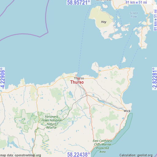
| Upper-left | 58.95721°, | -4.22906° |
| Center: | 58.59271°, | -3.52594° |
| Lower-right: | 58.22438°, | -2.82281° |
| Map W x H: | 81.5×81.5 km | = 50.6×50.6mi |
| max Lat: | 60.39635° ⇑0.2% North |
| Thurso: | 58.59271° |
| min Lat: | ⇓99.8% South 34.60088° |
| min Long | Thurso | max Long |
| -7.64133° | -3.52594° | 32.95536° |
| W 17.4%⇐ | ⇒82.6% E |
Elevation
Elevation of Thurso is 22 m = 72 ft, and this is 50.9 m = 167 ft below average elevation for this country.
| Max E: |
515 m = 1690 ft | 79% |
| Avg. | 72.9 m = 239 ft | |
| Thurso | 22 m = 72 ft | |
Min E: |
-30 m = -98 ft | 21% |
See also: United Kingdom elevation on elevation.city.
Geographical zone
Thurso is located in North temperate zone (between Tropic of Cancer and the Arctic Circle). Distance of this North polar circle is 886.3 km =550.7 mi to North.| Distance of | km | miles | from Thurso |
|---|---|---|---|
| North Pole | 3492.2 | 2170 | to North |
| Arctic Circle | 886.3 | 550.7 | to North |
| Tropic Cancer | 3909 | 2428.9 | to South |
| Equator | 6514.9 | 4048.2 | to South |


Nearby cities:
15 places around Thurso: (largest is in red/bold)
• Balintore
95.8 km =59.5 mi,  193°
193°
• Brora
67.5 km =41.9 mi,  196°
196°
• Burghead
99.2 km =61.6 mi,  178°
178°
• Castletown
8 km =5 mi,  89°
89°
• Dornoch
84.5 km =52.5 mi, 200°
• Golspie
73.8 km =45.9 mi, 200°
• Halkirk
9.2 km =5.7 mi,  167°
167°
• Helmsdale
53.4 km =33.2 mi, 187°
• Hopeman
98.7 km =61.3 mi, 176°
• Kirkwall
54.5 km =33.9 mi,  36°
36°
• Lossiemouth
97.9 km =60.8 mi, 171°
• Orkney
54.4 km =33.8 mi, 36°
• Stromness
43.5 km =27 mi,  17°
17°
• Tain
92.6 km =57.5 mi, 199°
• Wick
30.3 km =18.8 mi,  124°
124°
Sources, notices
• [Note1] Compared only with cities in United Kingdom existing in our database
• [Src1] Map data: © OpenStreetMap contributors (CC-BY-SA)
• [Src2] Other city data from geonames.org with taken over terms of usage.
• [Src3] Geographical zone / Annual Mean Temperature by Robert A. Rohde @ Wikipedia
