Shoreham-by-Sea geodata
Shoreham-by-Sea (England) is a populated place; located in United Kingdom in Europe/London (GMT+1) time zone. With population of 19,175 people, there are 623 cities with bigger population in this country. Compared to other cities in United Kingdom, 94.6% of cities are located further ↑North; 81.6% of cities are located further ←West and 96.2% of cities have higher elevation than Shoreham-by-Sea. Note1
Administrative division(s):
- Level 1: England
- Level 2: West Sussex
- Level 3: Adur District
- Level 4: Lancing


Shoreham-by-Sea GPS coordinates[2]
50° 50' 2.868" North, 0° 16' 27.516" West
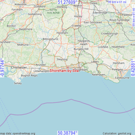
| Map corner | latitude | longitude |
|---|---|---|
| Upper-left | 51.27609°, | -0.97744° |
| Center: | 50.83413°, | -0.27431° |
| Lower-right: | 50.38794°, | 0.42881° |
| Map W x H: | 98.8×98.8 km | = 61.4×61.4mi |
| max Lat: | 60.39635° ⇑94.6% North |
| Shoreham-by-Sea: | 50.83413° |
| min Lat: | ⇓5.4% South 34.60088° |
| min Long | Shoreham-by-Sea | max Long |
| -7.64133° | -0.27431° | 32.95536° |
| W 81.6%⇐ | ⇒18.4% E |
Elevation
Elevation of Shoreham-by-Sea is 7 m = 23 ft, and this is 65.9 m = 216 ft below average elevation for this country.
| Max E: |
515 m = 1690 ft | 96.2% |
| Avg. | 72.9 m = 239 ft | |
| Shoreham-by-Sea | 7 m = 23 ft | |
Min E: |
-30 m = -98 ft | 3.8% |
See also: United Kingdom elevation on elevation.city.
Geographical zone
Shoreham-by-Sea is located in North temperate zone (between Tropic of Cancer and the Arctic Circle). Distance of this North polar circle is 1748.9 km =1086.7 mi to North.| Distance of | km | miles | from Shoreham-by-Sea |
|---|---|---|---|
| North Pole | 4354.8 | 2705.9 | to North |
| Arctic Circle | 1748.9 | 1086.7 | to North |
| Tropic Cancer | 3046.3 | 1892.9 | to South |
| Equator | 5652.2 | 3512.1 | to South |


Nearby cities:
15 places around Shoreham-by-Sea: (largest is in red/bold)
• Ashurst
11.5 km =7.1 mi,  342°
342°
• Brighton
9.5 km =5.9 mi,  93°
93°
• Broadwater
7.2 km =4.5 mi,  265°
265°
• Findon
10.1 km =6.3 mi,  292°
292°
• Fulking
7 km =4.3 mi,  28°
28°
• Goring-by-Sea
10.6 km =6.6 mi,  256°
256°
• Henfield
10.7 km =6.6 mi,  1°
1°
• Hove
7.5 km =4.7 mi, 92°
• Hurstpierpoint
12.9 km =8 mi, 30°
• Lancing
3.4 km =2.1 mi, 260°
• Portslade
4.2 km =2.6 mi,  76°
76°
• Small Dole
7.3 km =4.5 mi,  357°
357°
• Steyning
7 km =4.3 mi,  327°
327°
• Washington
12.2 km =7.6 mi,  310°
310°
• Worthing
7.3 km =4.5 mi, 255°
Sources, notices
• [Note1] Compared only with cities in United Kingdom existing in our database
• [Src1] Map data: © OpenStreetMap contributors (CC-BY-SA)
• [Src2] Other city data from geonames.org with taken over terms of usage.
• [Src3] Geographical zone / Annual Mean Temperature by Robert A. Rohde @ Wikipedia
