Poulton-le-Fylde geodata
Poulton-le-Fylde (England) is a populated place; located in United Kingdom in Europe/London (GMT+0) time zone. With population of 19,914 people, there are 600 cities with bigger population in this country. Compared to other cities in United Kingdom, 76.3% of cities are located further ↓South; 75% of cities are located further →East and 87% of cities have higher elevation than Poulton-le-Fylde. Note1


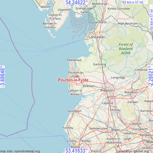
Poulton-le-Fylde GPS coordinates[2]
53° 49' 59.988" North, 2° 58' 59.988" West
| Map corner | latitude | longitude |
|---|---|---|
| Upper-left | 54.24622°, | -3.68646° |
| Center: | 53.83333°, | -2.98333° |
| Lower-right: | 53.41633°, | -2.28021° |
| Map W x H: | 92.3×92.3 km | = 57.4×57.4mi |
| max Lat: | 60.39635° ⇑23.7% North |
| Poulton-le-Fylde: | 53.83333° |
| min Lat: | ⇓76.3% South 34.60088° |
| min Long | Poulton-le-Fyld | max Long |
| -7.64133° | -2.98333° | 32.95536° |
| W 25%⇐ | ⇒75% E |
Elevation
Elevation of Poulton-le-Fylde is 14 m = 46 ft, and this is 58.9 m = 193 ft below average elevation for this country.
| Max E: |
515 m = 1690 ft | 87% |
| Avg. | 72.9 m = 239 ft | |
| Poulton-le-Fylde | 14 m = 46 ft | |
Min E: |
-30 m = -98 ft | 13% |
See also: United Kingdom elevation on elevation.city.
Geographical zone
Poulton-le-Fylde is located in North temperate zone (between Tropic of Cancer and the Arctic Circle). Distance of this North polar circle is 1415.5 km =879.6 mi to North.| Distance of | km | miles | from Poulton-le-Fylde |
|---|---|---|---|
| North Pole | 4021.4 | 2498.8 | to North |
| Arctic Circle | 1415.5 | 879.6 | to North |
| Tropic Cancer | 3379.8 | 2100.1 | to South |
| Equator | 5985.7 | 3719.3 | to South |


Nearby cities:
15 places around Poulton-le-Fylde: (largest is in red/bold)
• Blackpool
4.8 km =3 mi,  247°
247°
• Cleveleys
6.2 km =3.9 mi,  322°
322°
• Elswick
6.7 km =4.2 mi,  85°
85°
• Fleetwood
10.4 km =6.5 mi,  349°
349°
• Freckleton
11.7 km =7.3 mi,  138°
138°
• Fylde
4.4 km =2.7 mi, 90°
• Great Eccleston
7.7 km =4.8 mi,  73°
73°
• Great Marton
3.5 km =2.2 mi,  227°
227°
• Kirkham
9.2 km =5.7 mi,  127°
127°
• Lytham St Annes
10.1 km =6.3 mi,  185°
185°
• Preesall
9.5 km =5.9 mi,  6°
6°
• Thornton-Cleveleys
5.2 km =3.2 mi,  330°
330°
• Warton
11 km =6.8 mi,  147°
147°
• Weeton
3.2 km =2 mi,  114°
114°
• Wrea Green
7.7 km =4.8 mi, 144°
Sources, notices
• [Note1] Compared only with cities in United Kingdom existing in our database
• [Src1] Map data: © OpenStreetMap contributors (CC-BY-SA)
• [Src2] Other city data from geonames.org with taken over terms of usage.
• [Src3] Geographical zone / Annual Mean Temperature by Robert A. Rohde @ Wikipedia
