Blackpool geodata
Blackpool (England) is a seat of a second-order administrative division; located in United Kingdom in Europe/London (GMT+0) time zone. With population of 239,409 people, there are 32 cities with bigger population in this country. Compared to other cities in United Kingdom, 75.9% of cities are located further ↓South; 76.3% of cities are located further →East and 79.9% of cities have higher elevation than Blackpool. Note1


Blackpool GPS coordinates[2]
53° 49' 0.012" North, 3° 3' 0" West
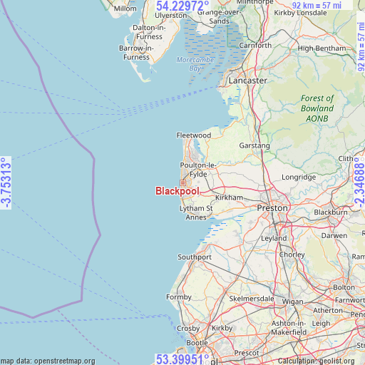
| Map corner | latitude | longitude |
|---|---|---|
| Upper-left | 54.22972°, | -3.75313° |
| Center: | 53.81667°, | -3.05° |
| Lower-right: | 53.39951°, | -2.34688° |
| Map W x H: | 92.3×92.3 km | = 57.4×57.4mi |
| max Lat: | 60.39635° ⇑24.1% North |
| Blackpool: | 53.81667° |
| min Lat: | ⇓75.9% South 34.60088° |
| min Long | Blackpool | max Long |
| -7.64133° | -3.05° | 32.95536° |
| W 23.7%⇐ | ⇒76.3% E |
Elevation
Elevation of Blackpool is 21 m = 69 ft, and this is 51.9 m = 170 ft below average elevation for this country.
| Max E: |
515 m = 1690 ft | 79.9% |
| Avg. | 72.9 m = 239 ft | |
| Blackpool | 21 m = 69 ft | |
Min E: |
-30 m = -98 ft | 20.1% |
See also: Blackpool elevation on elevation.city.
Geographical zone
Blackpool is located in North temperate zone (between Tropic of Cancer and the Arctic Circle). Distance of this North polar circle is 1417.3 km =880.7 mi to North.| Distance of | km | miles | from Blackpool |
|---|---|---|---|
| North Pole | 4023.2 | 2499.9 | to North |
| Arctic Circle | 1417.3 | 880.7 | to North |
| Tropic Cancer | 3377.9 | 2098.9 | to South |
| Equator | 5983.9 | 3718.2 | to South |


Nearby cities:
15 places around Blackpool: (largest is in red/bold)
• Cleveleys
6.8 km =4.2 mi,  5°
5°
• Elswick
11.3 km =7 mi,  77°
77°
• Fleetwood
12.3 km =7.6 mi, 11°
• Freckleton
14 km =8.7 mi,  119°
119°
• Fylde
8.9 km =5.5 mi, 78°
• Great Eccleston
12.5 km =7.8 mi,  71°
71°
• Great Marton
1.9 km =1.2 mi,  106°
106°
• Kirkham
12.3 km =7.6 mi, 108°
• Lytham St Annes
8.9 km =5.5 mi,  157°
157°
• Poulton-le-Fylde
4.8 km =3 mi, 67°
• Preesall
12.6 km =7.8 mi,  25°
25°
• Thornton-Cleveleys
6.6 km =4.1 mi,  15°
15°
• Warton
12.7 km =7.9 mi,  125°
125°
• Weeton
7.3 km =4.5 mi,  85°
85°
• Wrea Green
9.9 km =6.2 mi, 116°
Sources, notices
• [Note1] Compared only with cities in United Kingdom existing in our database
• [Src1] Map data: © OpenStreetMap contributors (CC-BY-SA)
• [Src2] Other city data from geonames.org with taken over terms of usage.
• [Src3] Geographical zone / Annual Mean Temperature by Robert A. Rohde @ Wikipedia
