Thornton-Cleveleys geodata
Thornton-Cleveleys (England) is a populated locality; located in United Kingdom in Europe/London (GMT+1) time zone. With population of 31,157 people, there are 392 cities with bigger population in this country. Compared to other cities in United Kingdom, 76.8% of cities are located further ↓South; 75.7% of cities are located further →East and 96.2% of cities have higher elevation than Thornton-Cleveleys. Note1


Thornton-Cleveleys GPS coordinates[2]
53° 52' 26.004" North, 3° 1' 20.784" West
| Map corner | latitude | longitude |
|---|---|---|
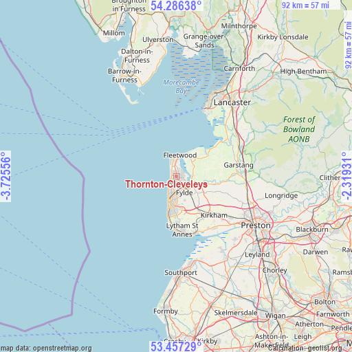
| Upper-left | 54.28638°, | -3.72556° |
| Center: | 53.87389°, | -3.02244° |
| Lower-right: | 53.45729°, | -2.31931° |
| Map W x H: | 92.2×92.2 km | = 57.3×57.3mi |
| max Lat: | 60.39635° ⇑23.2% North |
| Thornton-Cleveleys: | 53.87389° |
| min Lat: | ⇓76.8% South 34.60088° |
| min Long | Thornton-Clevel | max Long |
| -7.64133° | -3.02244° | 32.95536° |
| W 24.3%⇐ | ⇒75.7% E |
Elevation
Elevation of Thornton-Cleveleys is 7 m = 23 ft, and this is 65.9 m = 216 ft below average elevation for this country.
| Max E: |
515 m = 1690 ft | 96.2% |
| Avg. | 72.9 m = 239 ft | |
| Thornton-Cleveleys | 7 m = 23 ft | |
Min E: |
-30 m = -98 ft | 3.8% |
See also: United Kingdom elevation on elevation.city.
Geographical zone
Thornton-Cleveleys is located in North temperate zone (between Tropic of Cancer and the Arctic Circle). Distance of this North polar circle is 1411 km =876.8 mi to North.| Distance of | km | miles | from Thornton-Cleveleys |
|---|---|---|---|
| North Pole | 4016.8 | 2495.9 | to North |
| Arctic Circle | 1411 | 876.8 | to North |
| Tropic Cancer | 3384.3 | 2102.9 | to South |
| Equator | 5990.2 | 3722.1 | to South |


Nearby cities:
15 places around Thornton-Cleveleys: (largest is in red/bold)
• Blackpool
6.6 km =4.1 mi,  195°
195°
• Cleveleys
1.2 km =0.7 mi,  289°
289°
• Elswick
10.1 km =6.3 mi,  113°
113°
• Fleetwood
5.8 km =3.6 mi,  7°
7°
• Fylde
8.3 km =5.2 mi,  123°
123°
• Garstang
16.5 km =10.3 mi,  79°
79°
• Great Eccleston
10.2 km =6.3 mi,  103°
103°
• Great Marton
6.9 km =4.3 mi,  180°
180°
• Kirkham
14.2 km =8.8 mi,  135°
135°
• Lytham St Annes
14.7 km =9.1 mi,  173°
173°
• Poulton-le-Fylde
5.2 km =3.2 mi,  150°
150°
• Preesall
6.1 km =3.8 mi,  36°
36°
• Warton
16.2 km =10.1 mi, 148°
• Weeton
8 km =5 mi, 136°
• Wrea Green
12.9 km =8 mi, 147°
Sources, notices
• [Note1] Compared only with cities in United Kingdom existing in our database
• [Src1] Map data: © OpenStreetMap contributors (CC-BY-SA)
• [Src2] Other city data from geonames.org with taken over terms of usage.
• [Src3] Geographical zone / Annual Mean Temperature by Robert A. Rohde @ Wikipedia
