Perth geodata
Perth (Scotland) is a seat of a second-order administrative division; located in United Kingdom in Europe/London (GMT+1) time zone. With population of 47,180 people, there are 250 cities with bigger population in this country. Compared to other cities in United Kingdom, 96.4% of cities are located further ↓South; 81.2% of cities are located further →East and 92.6% of cities have higher elevation than Perth. Note1


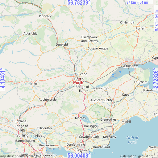
Perth GPS coordinates[2]
56° 23' 42.792" North, 3° 25' 53.004" West
| Map corner | latitude | longitude |
|---|---|---|
| Upper-left | 56.78239°, | -4.13451° |
| Center: | 56.39522°, | -3.43139° |
| Lower-right: | 56.00408°, | -2.72826° |
| Map W x H: | 86.5×86.5 km | = 53.7×53.7mi |
| max Lat: | 60.39635° ⇑3.6% North |
| Perth: | 56.39522° |
| min Lat: | ⇓96.4% South 34.60088° |
| min Long | Perth | max Long |
| -7.64133° | -3.43139° | 32.95536° |
| W 18.8%⇐ | ⇒81.2% E |
Elevation
Elevation of Perth is 10 m = 33 ft, and this is 62.9 m = 206 ft below average elevation for this country.
| Max E: |
515 m = 1690 ft | 92.6% |
| Avg. | 72.9 m = 239 ft | |
| Perth | 10 m = 33 ft | |
Min E: |
-30 m = -98 ft | 7.4% |
See also: Perth elevation on elevation.city.
Geographical zone
Perth is located in North temperate zone (between Tropic of Cancer and the Arctic Circle). Distance of this North polar circle is 1130.6 km =702.5 mi to North.| Distance of | km | miles | from Perth |
|---|---|---|---|
| North Pole | 3736.5 | 2321.8 | to North |
| Arctic Circle | 1130.6 | 702.5 | to North |
| Tropic Cancer | 3664.6 | 2277.1 | to South |
| Equator | 6270.6 | 3896.4 | to South |


Nearby cities:
15 places around Perth: (largest is in red/bold)
• Abernethy
10.1 km =6.3 mi,  133°
133°
• Almondbank
5.8 km =3.6 mi,  294°
294°
• Bankfoot
12.8 km =8 mi,  335°
335°
• Bridge of Earn
5.4 km =3.4 mi,  163°
163°
• Burrelton
16.1 km =10 mi,  29°
29°
• Dunning
13.3 km =8.3 mi,  225°
225°
• Errol
13.5 km =8.4 mi,  91°
91°
• Forgandenny
6.2 km =3.9 mi,  207°
207°
• Glenfarg
12.9 km =8 mi,  171°
171°
• Luncarty
6.9 km =4.3 mi, 339°
• Methven
9.4 km =5.8 mi, 285°
• Murthly
15 km =9.3 mi,  351°
351°
• Newburgh
13 km =8.1 mi,  112°
112°
• Scone
3.1 km =1.9 mi, 31°
• Stanley
10.1 km =6.3 mi, 352°
Sources, notices
• [Note1] Compared only with cities in United Kingdom existing in our database
• [Src1] Map data: © OpenStreetMap contributors (CC-BY-SA)
• [Src2] Other city data from geonames.org with taken over terms of usage.
• [Src3] Geographical zone / Annual Mean Temperature by Robert A. Rohde @ Wikipedia
