Forgandenny geodata
Forgandenny (Scotland) is a populated place; located in United Kingdom in Europe/London (GMT+1) time zone. With population of 590 people, there are 4612 cities with bigger population in this country. Compared to other cities in United Kingdom, 96.2% of cities are located further ↓South; 81.9% of cities are located further →East and 62.4% of cities have higher elevation than Forgandenny. Note1


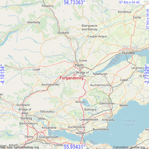
Forgandenny GPS coordinates[2]
56° 20' 45.456" North, 3° 28' 42.276" West
| Map corner | latitude | longitude |
|---|---|---|
| Upper-left | 56.73363°, | -4.18154° |
| Center: | 56.34596°, | -3.47841° |
| Lower-right: | 55.95431°, | -2.77529° |
| Map W x H: | 86.7×86.6 km | = 53.9×53.8mi |
| max Lat: | 60.39635° ⇑3.8% North |
| Forgandenny: | 56.34596° |
| min Lat: | ⇓96.2% South 34.60088° |
| min Long | Forgandenny | max Long |
| -7.64133° | -3.47841° | 32.95536° |
| W 18.1%⇐ | ⇒81.9% E |
Elevation
Elevation of Forgandenny is 43 m = 141 ft, and this is 29.9 m = 98 ft below average elevation for this country.
| Max E: |
515 m = 1690 ft | 62.4% |
| Avg. | 72.9 m = 239 ft | |
| Forgandenny | 43 m = 141 ft | |
Min E: |
-30 m = -98 ft | 37.6% |
See also: United Kingdom elevation on elevation.city.
Geographical zone
Forgandenny is located in North temperate zone (between Tropic of Cancer and the Arctic Circle). Distance of this North polar circle is 1136.1 km =705.9 mi to North.| Distance of | km | miles | from Forgandenny |
|---|---|---|---|
| North Pole | 3742 | 2325.2 | to North |
| Arctic Circle | 1136.1 | 705.9 | to North |
| Tropic Cancer | 3659.2 | 2273.7 | to South |
| Equator | 6265.1 | 3893 | to South |


Nearby cities:
15 places around Forgandenny: (largest is in red/bold)
• Abernethy
10.3 km =6.4 mi,  98°
98°
• Almondbank
8.3 km =5.2 mi,  343°
343°
• Auchterarder
15.1 km =9.4 mi,  248°
248°
• Bridge of Earn
4.4 km =2.7 mi,  86°
86°
• Dunning
7.7 km =4.8 mi,  240°
240°
• Glenfarg
8.8 km =5.5 mi,  146°
146°
• Kinross
16.1 km =10 mi,  167°
167°
• Luncarty
11.9 km =7.4 mi,  2°
2°
• Methven
10 km =6.2 mi,  322°
322°
• Milnathort
13.7 km =8.5 mi,  164°
164°
• Newburgh
14.9 km =9.3 mi, 87°
• Perth
6.2 km =3.9 mi,  27°
27°
• Scone
9.3 km =5.8 mi, 28°
• Stanley
15.6 km =9.7 mi,  6°
6°
• Strathmiglo
14.9 km =9.3 mi,  120°
120°
Sources, notices
• [Note1] Compared only with cities in United Kingdom existing in our database
• [Src1] Map data: © OpenStreetMap contributors (CC-BY-SA)
• [Src2] Other city data from geonames.org with taken over terms of usage.
• [Src3] Geographical zone / Annual Mean Temperature by Robert A. Rohde @ Wikipedia
