Dunning geodata
Dunning (Scotland) is a populated place; located in United Kingdom in Europe/London (GMT+1) time zone. With population of 930 people, there are 3764 cities with bigger population in this country. Compared to other cities in United Kingdom, 96.1% of cities are located further ↓South; 83.5% of cities are located further →East and 51.7% of cities have higher elevation than Dunning. Note1


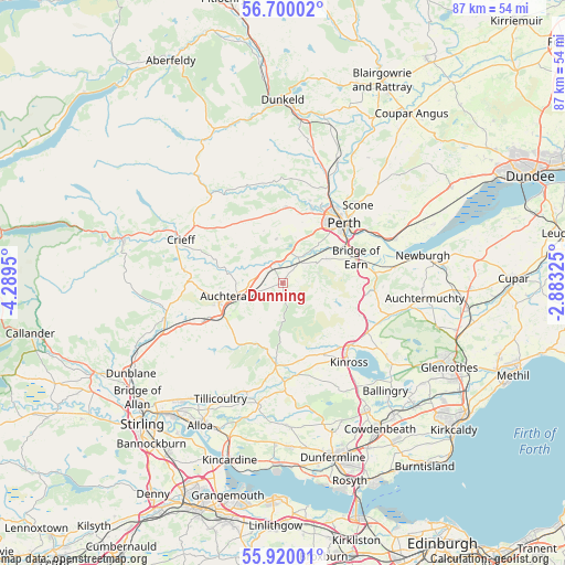
Dunning GPS coordinates[2]
56° 18' 43.236" North, 3° 35' 10.968" West
| Map corner | latitude | longitude |
|---|---|---|
| Upper-left | 56.70002°, | -4.2895° |
| Center: | 56.31201°, | -3.58638° |
| Lower-right: | 55.92001°, | -2.88325° |
| Map W x H: | 86.7×86.7 km | = 53.9×53.9mi |
| max Lat: | 60.39635° ⇑3.9% North |
| Dunning: | 56.31201° |
| min Lat: | ⇓96.1% South 34.60088° |
| min Long | Dunning | max Long |
| -7.64133° | -3.58638° | 32.95536° |
| W 16.5%⇐ | ⇒83.5% E |
Elevation
Elevation of Dunning is 58 m = 190 ft, and this is 14.9 m = 49 ft below average elevation for this country.
| Max E: |
515 m = 1690 ft | 51.7% |
| Avg. | 72.9 m = 239 ft | |
| Dunning | 58 m = 190 ft | |
Min E: |
-30 m = -98 ft | 48.3% |
See also: United Kingdom elevation on elevation.city.
Geographical zone
Dunning is located in North temperate zone (between Tropic of Cancer and the Arctic Circle). Distance of this North polar circle is 1139.9 km =708.3 mi to North.| Distance of | km | miles | from Dunning |
|---|---|---|---|
| North Pole | 3745.8 | 2327.5 | to North |
| Arctic Circle | 1139.9 | 708.3 | to North |
| Tropic Cancer | 3655.4 | 2271.4 | to South |
| Equator | 6261.3 | 3890.6 | to South |


Nearby cities:
15 places around Dunning: (largest is in red/bold)
• Abernethy
17.1 km =10.6 mi,  82°
82°
• Almondbank
12.5 km =7.8 mi,  19°
19°
• Auchterarder
7.6 km =4.7 mi,  256°
256°
• Blackford
13.5 km =8.4 mi,  244°
244°
• Bridge of Earn
11.8 km =7.3 mi,  69°
69°
• Crieff
17 km =10.6 mi,  293°
293°
• Crook of Devon
14.3 km =8.9 mi,  172°
172°
• Forgandenny
7.7 km =4.8 mi,  60°
60°
• Glenfarg
12 km =7.5 mi,  107°
107°
• Kinross
15.7 km =9.8 mi,  139°
139°
• Methven
11.7 km =7.3 mi,  2°
2°
• Milnathort
14 km =8.7 mi,  132°
132°
• Muthill
15.4 km =9.6 mi,  278°
278°
• Perth
13.3 km =8.3 mi,  45°
45°
• Scone
16.3 km =10.1 mi,  43°
43°
Sources, notices
• [Note1] Compared only with cities in United Kingdom existing in our database
• [Src1] Map data: © OpenStreetMap contributors (CC-BY-SA)
• [Src2] Other city data from geonames.org with taken over terms of usage.
• [Src3] Geographical zone / Annual Mean Temperature by Robert A. Rohde @ Wikipedia
