Nettlebed geodata
Nettlebed (England) is a populated place; located in United Kingdom in Europe/London (GMT+1) time zone. With population of 727 people, there are 4200 cities with bigger population in this country. Compared to other cities in United Kingdom, 75.2% of cities are located further ↑North; 66.9% of cities are located further ←West and 95.6% of cities have lower elevation than Nettlebed. Note1
Administrative division(s):
- Level 1: England
- Level 2: Oxfordshire
- Level 3: South Oxfordshire District
- Level 4: Nettlebed


Nettlebed GPS coordinates[2]
51° 34' 31.692" North, 0° 59' 22.668" West
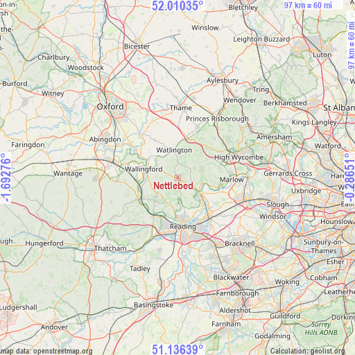
| Map corner | latitude | longitude |
|---|---|---|
| Upper-left | 52.01035°, | -1.69276° |
| Center: | 51.57547°, | -0.98963° |
| Lower-right: | 51.13639°, | -0.28651° |
| Map W x H: | 97.2×97.2 km | = 60.4×60.4mi |
| max Lat: | 60.39635° ⇑75.2% North |
| Nettlebed: | 51.57547° |
| min Lat: | ⇓24.8% South 34.60088° |
| min Long | Nettlebed | max Long |
| -7.64133° | -0.98963° | 32.95536° |
| W 66.9%⇐ | ⇒33.1% E |
Elevation
Elevation of Nettlebed is 190 m = 623 ft, and this is 117.1 m = 384 ft above average elevation for this country.
| Max E: |
515 m = 1690 ft | 4.4% |
| Nettlebed | 190 m 623 ft | |
| Avg. | 72.9 m = 239 ft | |
Min E: |
-30 m = -98 ft | 95.6% |
See also: United Kingdom elevation on elevation.city.
Geographical zone
Nettlebed is located in North temperate zone (between Tropic of Cancer and the Arctic Circle). Distance of this North polar circle is 1666.5 km =1035.5 mi to North.| Distance of | km | miles | from Nettlebed |
|---|---|---|---|
| North Pole | 4272.4 | 2654.7 | to North |
| Arctic Circle | 1666.5 | 1035.5 | to North |
| Tropic Cancer | 3128.7 | 1944.1 | to South |
| Equator | 5734.7 | 3563.4 | to South |


Nearby cities:
15 places around Nettlebed: (largest is in red/bold)
• Benson
9.7 km =6 mi,  301°
301°
• Binfield Heath
9.4 km =5.8 mi,  152°
152°
• Chalgrove
11.6 km =7.2 mi,  328°
328°
• Cholsey
11.3 km =7 mi,  268°
268°
• Frieth
10.1 km =6.3 mi,  70°
70°
• Goring
11.5 km =7.1 mi,  239°
239°
• Henley-on-Thames
7.8 km =4.8 mi,  127°
127°
• Remenham
7.3 km =4.5 mi,  111°
111°
• Rotherfield Peppard
5 km =3.1 mi,  171°
171°
• Shiplake
10.3 km =6.4 mi,  144°
144°
• Sonning Common
6.4 km =4 mi, 172°
• Stokenchurch
11.2 km =7 mi,  34°
34°
• Wallingford
9.7 km =6 mi,  286°
286°
• Wargrave
11.9 km =7.4 mi, 134°
• Watlington
7.6 km =4.7 mi,  352°
352°
Sources, notices
• [Note1] Compared only with cities in United Kingdom existing in our database
• [Src1] Map data: © OpenStreetMap contributors (CC-BY-SA)
• [Src2] Other city data from geonames.org with taken over terms of usage.
• [Src3] Geographical zone / Annual Mean Temperature by Robert A. Rohde @ Wikipedia
