Mareham le Fen geodata
Mareham le Fen (England) is a populated place; located in United Kingdom in Europe/London (GMT+1) time zone. With population of 944 people, there are 3737 cities with bigger population in this country. Compared to other cities in United Kingdom, 62.7% of cities are located further ↓South; 85.1% of cities are located further ←West and 91.2% of cities have higher elevation than Mareham le Fen. Note1
Administrative division(s):
- Level 1: England
- Level 2: Lincolnshire
- Level 3: East Lindsey District
- Level 4: Mareham Le Fen


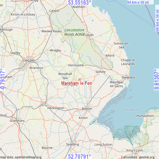
Mareham le Fen GPS coordinates[2]
53° 7' 54.624" North, 0° 5' 24.18" West
| Map corner | latitude | longitude |
|---|---|---|
| Upper-left | 53.55163°, | -0.79317° |
| Center: | 53.13184°, | -0.09005° |
| Lower-right: | 52.70791°, | 0.61307° |
| Map W x H: | 93.8×93.8 km | = 58.3×58.3mi |
| max Lat: | 60.39635° ⇑37.3% North |
| Mareham le Fen: | 53.13184° |
| min Lat: | ⇓62.7% South 34.60088° |
| min Long | Mareham le Fen | max Long |
| -7.64133° | -0.09005° | 32.95536° |
| W 85.1%⇐ | ⇒14.9% E |
Elevation
Elevation of Mareham le Fen is 11 m = 36 ft, and this is 61.9 m = 203 ft below average elevation for this country.
| Max E: |
515 m = 1690 ft | 91.2% |
| Avg. | 72.9 m = 239 ft | |
| Mareham le Fen | 11 m = 36 ft | |
Min E: |
-30 m = -98 ft | 8.8% |
See also: United Kingdom elevation on elevation.city.
Geographical zone
Mareham le Fen is located in North temperate zone (between Tropic of Cancer and the Arctic Circle). Distance of this North polar circle is 1493.5 km =928 mi to North.| Distance of | km | miles | from Mareham le Fen |
|---|---|---|---|
| North Pole | 4099.4 | 2547.2 | to North |
| Arctic Circle | 1493.5 | 928 | to North |
| Tropic Cancer | 3301.8 | 2051.6 | to South |
| Equator | 5907.7 | 3670.9 | to South |


Nearby cities:
15 places around Mareham le Fen: (largest is in red/bold)
• Bardney
17.8 km =11.1 mi,  299°
299°
• Billinghay
13.8 km =8.6 mi,  245°
245°
• Boston
17.8 km =11.1 mi,  166°
166°
• Coningsby
6.4 km =4 mi,  243°
243°
• Horncastle
8.6 km =5.3 mi,  347°
347°
• Martin
15.8 km =9.8 mi,  267°
267°
• Old Leake
16.9 km =10.5 mi,  131°
131°
• Sibsey
12.5 km =7.8 mi,  145°
145°
• Spilsby
13.1 km =8.1 mi,  69°
69°
• Stickney
7.9 km =4.9 mi, 126°
• Thimbleby
9.7 km =6 mi,  338°
338°
• Timberland
16.1 km =10 mi,  262°
262°
• Walcott
15.4 km =9.6 mi, 254°
• Woodhall Spa
8.6 km =5.3 mi,  285°
285°
• Wrangle
17.9 km =11.1 mi,  124°
124°
Sources, notices
• [Note1] Compared only with cities in United Kingdom existing in our database
• [Src1] Map data: © OpenStreetMap contributors (CC-BY-SA)
• [Src2] Other city data from geonames.org with taken over terms of usage.
• [Src3] Geographical zone / Annual Mean Temperature by Robert A. Rohde @ Wikipedia
