Llanfyllin geodata
Llanfyllin (Wales) is a seat of a third-order administrative division; located in United Kingdom in Europe/London (GMT+1) time zone. With population of 1,105 people, there are 3482 cities with bigger population in this country. Compared to other cities in United Kingdom, 56.6% of cities are located further ↓South; 79.3% of cities are located further →East and 82.8% of cities have lower elevation than Llanfyllin. Note1


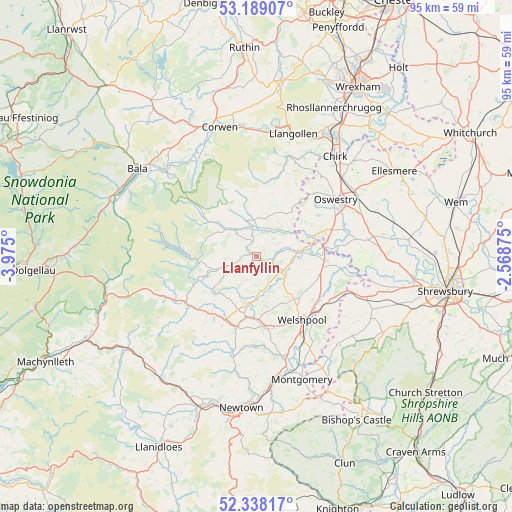
Llanfyllin GPS coordinates[2]
52° 45' 56.52" North, 3° 16' 18.732" West
| Map corner | latitude | longitude |
|---|---|---|
| Upper-left | 53.18907°, | -3.975° |
| Center: | 52.7657°, | -3.27187° |
| Lower-right: | 52.33817°, | -2.56875° |
| Map W x H: | 94.6×94.6 km | = 58.8×58.8mi |
| max Lat: | 60.39635° ⇑43.4% North |
| Llanfyllin: | 52.7657° |
| min Lat: | ⇓56.6% South 34.60088° |
| min Long | Llanfyllin | max Long |
| -7.64133° | -3.27187° | 32.95536° |
| W 20.7%⇐ | ⇒79.3% E |
Elevation
Elevation of Llanfyllin is 126 m = 413 ft, and this is 53.1 m = 174 ft above average elevation for this country.
| Max E: |
515 m = 1690 ft | 17.2% |
| Llanfyllin | 126 m 413 ft | |
| Avg. | 72.9 m = 239 ft | |
Min E: |
-30 m = -98 ft | 82.8% |
See also: United Kingdom elevation on elevation.city.
Geographical zone
Llanfyllin is located in North temperate zone (between Tropic of Cancer and the Arctic Circle). Distance of this North polar circle is 1534.2 km =953.3 mi to North.| Distance of | km | miles | from Llanfyllin |
|---|---|---|---|
| North Pole | 4140.1 | 2572.5 | to North |
| Arctic Circle | 1534.2 | 953.3 | to North |
| Tropic Cancer | 3261.1 | 2026.4 | to South |
| Equator | 5867 | 3645.6 | to South |


Nearby cities:
15 places around Llanfyllin: (largest is in red/bold)
• Forden
19.5 km =12.1 mi,  149°
149°
• Four Crosses
12.9 km =8 mi,  93°
93°
• Guilsfield
10.9 km =6.8 mi,  134°
134°
• Llandrillo
20.7 km =12.9 mi,  327°
327°
• Llanfair Caereinion
13.6 km =8.5 mi,  195°
195°
• Llanfechain
4.8 km =3 mi,  77°
77°
• Llangynog
11.4 km =7.1 mi,  311°
311°
• Llanrhaeadr-ym-Mochnant
6.9 km =4.3 mi,  342°
342°
• Llanymynech
12.4 km =7.7 mi, 82°
• Oswestry
18.1 km =11.2 mi,  53°
53°
• Pant
13.2 km =8.2 mi, 78°
• Trefonen
13.8 km =8.6 mi,  56°
56°
• Tregynon
21.1 km =13.1 mi,  191°
191°
• Welshpool
14.5 km =9 mi,  144°
144°
• West Felton
21.1 km =13.1 mi,  71°
71°
Sources, notices
• [Note1] Compared only with cities in United Kingdom existing in our database
• [Src1] Map data: © OpenStreetMap contributors (CC-BY-SA)
• [Src2] Other city data from geonames.org with taken over terms of usage.
• [Src3] Geographical zone / Annual Mean Temperature by Robert A. Rohde @ Wikipedia
