Llandudno geodata
Llandudno (Wales) is a seat of a third-order administrative division; located in United Kingdom in Europe/London (GMT+1) time zone. With population of 15,371 people, there are 751 cities with bigger population in this country. Compared to other cities in United Kingdom, 66.4% of cities are located further ↓South; 86.1% of cities are located further →East and 92.6% of cities have higher elevation than Llandudno. Note1


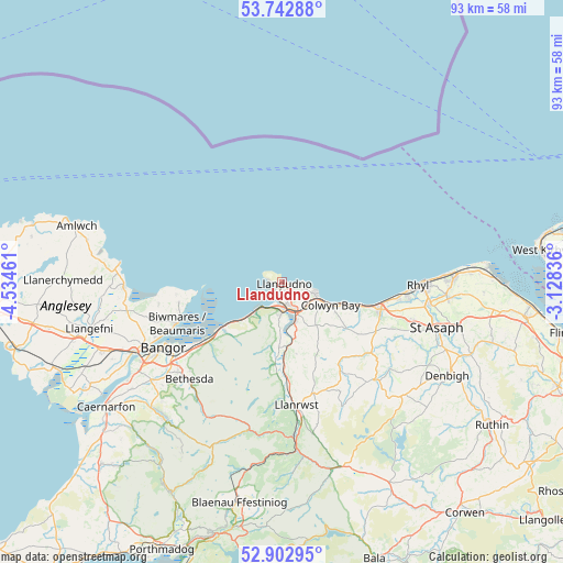
Llandudno GPS coordinates[2]
53° 19' 29.928" North, 3° 49' 53.328" West
| Map corner | latitude | longitude |
|---|---|---|
| Upper-left | 53.74288°, | -4.53461° |
| Center: | 53.32498°, | -3.83148° |
| Lower-right: | 52.90295°, | -3.12836° |
| Map W x H: | 93.4×93.4 km | = 58×58mi |
| max Lat: | 60.39635° ⇑33.6% North |
| Llandudno: | 53.32498° |
| min Lat: | ⇓66.4% South 34.60088° |
| min Long | Llandudno | max Long |
| -7.64133° | -3.83148° | 32.95536° |
| W 13.9%⇐ | ⇒86.1% E |
Elevation
Elevation of Llandudno is 10 m = 33 ft, and this is 62.9 m = 206 ft below average elevation for this country.
| Max E: |
515 m = 1690 ft | 92.6% |
| Avg. | 72.9 m = 239 ft | |
| Llandudno | 10 m = 33 ft | |
Min E: |
-30 m = -98 ft | 7.4% |
See also: United Kingdom elevation on elevation.city.
Geographical zone
Llandudno is located in North temperate zone (between Tropic of Cancer and the Arctic Circle). Distance of this North polar circle is 1472 km =914.7 mi to North.| Distance of | km | miles | from Llandudno |
|---|---|---|---|
| North Pole | 4077.9 | 2533.9 | to North |
| Arctic Circle | 1472 | 914.7 | to North |
| Tropic Cancer | 3323.3 | 2065 | to South |
| Equator | 5929.2 | 3684.2 | to South |


Nearby cities:
15 places around Llandudno: (largest is in red/bold)
• Aber
16 km =9.9 mi,  230°
230°
• Abergele
17.2 km =10.7 mi,  105°
105°
• Beaumaris
18.6 km =11.6 mi,  248°
248°
• Colwyn Bay
7.7 km =4.8 mi,  115°
115°
• Conwy
4.9 km =3 mi,  179°
179°
• Deganwy
2.3 km =1.4 mi,  173°
173°
• Llanddona
20.6 km =12.8 mi,  259°
259°
• Llanfairfechan
12.1 km =7.5 mi, 231°
• Llangoed
17.4 km =10.8 mi, 258°
• Llanrwst
20.7 km =12.9 mi, 173°
• Llansantffraid Glan Conwy
6.8 km =4.2 mi,  162°
162°
• Llysfaen
11.9 km =7.4 mi, 112°
• Mochdre
7.1 km =4.4 mi,  130°
130°
• Penmaenmawr
9.4 km =5.8 mi, 226°
• Trefriw
19.3 km =12 mi, 178°
Sources, notices
• [Note1] Compared only with cities in United Kingdom existing in our database
• [Src1] Map data: © OpenStreetMap contributors (CC-BY-SA)
• [Src2] Other city data from geonames.org with taken over terms of usage.
• [Src3] Geographical zone / Annual Mean Temperature by Robert A. Rohde @ Wikipedia
