Irvinestown geodata
Irvinestown (Northern Ireland) is a populated place; located in United Kingdom in Europe/London (GMT+1) time zone. With population of 1,765 people, there are 2801 cities with bigger population in this country. Compared to other cities in United Kingdom, 81.7% of cities are located further ↓South; 100% of cities are located further →East and 66.5% of cities have lower elevation than Irvinestown. Note1


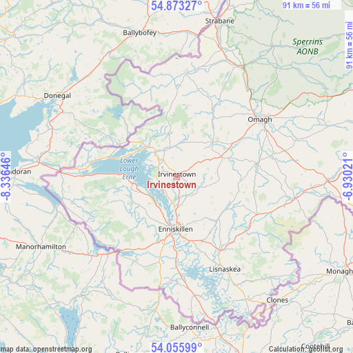
Irvinestown GPS coordinates[2]
54° 28' 0.012" North, 7° 37' 59.988" West
| Map corner | latitude | longitude |
|---|---|---|
| Upper-left | 54.87327°, | -8.33646° |
| Center: | 54.46667°, | -7.63333° |
| Lower-right: | 54.05599°, | -6.93021° |
| Map W x H: | 90.9×90.9 km | = 56.5×56.5mi |
| max Lat: | 60.39635° ⇑18.3% North |
| Irvinestown: | 54.46667° |
| min Lat: | ⇓81.7% South 34.60088° |
| min Long | Irvinestown | max Long |
| -7.64133° | -7.63333° | 32.95536° |
| W 0%⇐ | ⇒100% E |
Elevation
Elevation of Irvinestown is 89 m = 292 ft, and this is 16.1 m = 53 ft above average elevation for this country.
| Max E: |
515 m = 1690 ft | 33.5% |
| Irvinestown | 89 m 292 ft | |
| Avg. | 72.9 m = 239 ft | |
Min E: |
-30 m = -98 ft | 66.5% |
See also: United Kingdom elevation on elevation.city.
Geographical zone
Irvinestown is located in North temperate zone (between Tropic of Cancer and the Arctic Circle). Distance of this North polar circle is 1345 km =835.7 mi to North.| Distance of | km | miles | from Irvinestown |
|---|---|---|---|
| North Pole | 3950.9 | 2455 | to North |
| Arctic Circle | 1345 | 835.7 | to North |
| Tropic Cancer | 3450.2 | 2143.9 | to South |
| Equator | 6056.1 | 3763.1 | to South |


Nearby cities:
15 places around Irvinestown: (largest is in red/bold)
• Ballinamallard
8.1 km =5 mi,  156°
156°
• Castlederg
26.8 km =16.7 mi,  5°
5°
• Coalisland
60.7 km =37.7 mi,  82°
82°
• Cookstown
60.5 km =37.6 mi,  71°
71°
• Dromore
12.4 km =7.7 mi, 65°
• Dungannon
56.1 km =34.9 mi,  85°
85°
• Enniskillen
13.4 km =8.3 mi,  182°
182°
• Fintona
20.8 km =12.9 mi, 79°
• Fivemiletown
23.5 km =14.6 mi,  113°
113°
• Lisnaskea
26.9 km =16.7 mi,  153°
153°
• Newtownbutler
36.2 km =22.5 mi, 150°
• Newtownstewart
32.4 km =20.1 mi,  30°
30°
• Omagh
26.1 km =16.2 mi,  55°
55°
• Sion Mills
37.1 km =23.1 mi,  16°
16°
• Strabane
41.1 km =25.5 mi, 14°
Sources, notices
• [Note1] Compared only with cities in United Kingdom existing in our database
• [Src1] Map data: © OpenStreetMap contributors (CC-BY-SA)
• [Src2] Other city data from geonames.org with taken over terms of usage.
• [Src3] Geographical zone / Annual Mean Temperature by Robert A. Rohde @ Wikipedia
