Hailsham geodata
Hailsham (England) is a populated place; located in United Kingdom in Europe/London (GMT+1) time zone. With population of 19,977 people, there are 598 cities with bigger population in this country. Compared to other cities in United Kingdom, 94% of cities are located further ↑North; 89.8% of cities are located further ←West and 74% of cities have higher elevation than Hailsham. Note1
Administrative division(s):
- Level 1: England
- Level 2: East Sussex
- Level 3: Wealden District
- Level 4: Hailsham


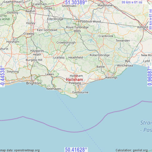
Hailsham GPS coordinates[2]
50° 51' 43.92" North, 0° 15' 27.9" East
| Map corner | latitude | longitude |
|---|---|---|
| Upper-left | 51.30389°, | -0.44538° |
| Center: | 50.8622°, | 0.25775° |
| Lower-right: | 50.41628°, | 0.96087° |
| Map W x H: | 98.7×98.7 km | = 61.3×61.3mi |
| max Lat: | 60.39635° ⇑94% North |
| Hailsham: | 50.8622° |
| min Lat: | ⇓6% South 34.60088° |
| min Long | Hailsham | max Long |
| -7.64133° | 0.25775° | 32.95536° |
| W 89.8%⇐ | ⇒10.2% E |
Elevation
Elevation of Hailsham is 28 m = 92 ft, and this is 44.9 m = 147 ft below average elevation for this country.
| Max E: |
515 m = 1690 ft | 74% |
| Avg. | 72.9 m = 239 ft | |
| Hailsham | 28 m = 92 ft | |
Min E: |
-30 m = -98 ft | 26% |
See also: United Kingdom elevation on elevation.city.
Geographical zone
Hailsham is located in North temperate zone (between Tropic of Cancer and the Arctic Circle). Distance of this North polar circle is 1745.8 km =1084.8 mi to North.| Distance of | km | miles | from Hailsham |
|---|---|---|---|
| North Pole | 4351.7 | 2704 | to North |
| Arctic Circle | 1745.8 | 1084.8 | to North |
| Tropic Cancer | 3049.4 | 1894.8 | to South |
| Equator | 5655.3 | 3514 | to South |


Nearby cities:
15 places around Hailsham: (largest is in red/bold)
• Alfriston
9.3 km =5.8 mi,  229°
229°
• Bodle Street
8.2 km =5.1 mi,  46°
46°
• Burwash Common
14.8 km =9.2 mi,  23°
23°
• Catsfield
14.1 km =8.8 mi,  74°
74°
• East Hoathly
9.6 km =6 mi,  316°
316°
• Eastbourne
10.6 km =6.6 mi,  169°
169°
• Framfield
14.5 km =9 mi, 320°
• Friston
11.7 km =7.3 mi,  200°
200°
• Heathfield
11.7 km =7.3 mi,  359°
359°
• Herstmonceux
5.5 km =3.4 mi,  56°
56°
• Horam
8.2 km =5.1 mi,  353°
353°
• Ninfield
12.1 km =7.5 mi,  77°
77°
• Pevensey
7.4 km =4.6 mi,  129°
129°
• Pevensey Bay
8.4 km =5.2 mi, 130°
• Ringmer
14.6 km =9.1 mi,  283°
283°
Sources, notices
• [Note1] Compared only with cities in United Kingdom existing in our database
• [Src1] Map data: © OpenStreetMap contributors (CC-BY-SA)
• [Src2] Other city data from geonames.org with taken over terms of usage.
• [Src3] Geographical zone / Annual Mean Temperature by Robert A. Rohde @ Wikipedia
