Eastbourne geodata
Eastbourne (England) is a populated place; located in United Kingdom in Europe/London (GMT+1) time zone. With population of 118,219 people, there are 78 cities with bigger population in this country. Compared to other cities in United Kingdom, 95.7% of cities are located further ↑North; 90.2% of cities are located further ←West and 94.9% of cities have higher elevation than Eastbourne. Note1


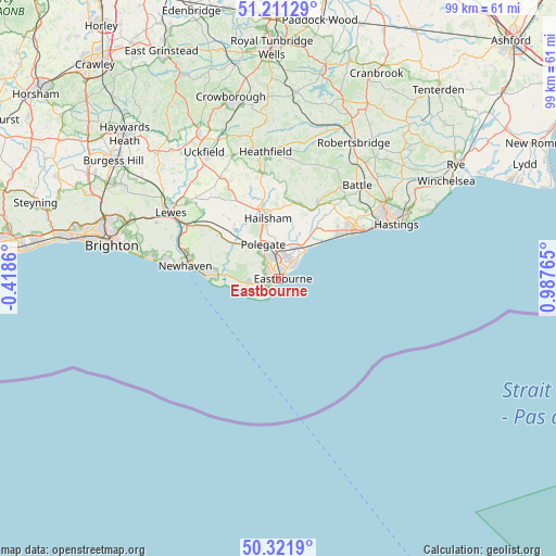
Eastbourne GPS coordinates[2]
50° 46' 7.356" North, 0° 17' 4.308" East
| Map corner | latitude | longitude |
|---|---|---|
| Upper-left | 51.21129°, | -0.4186° |
| Center: | 50.76871°, | 0.28453° |
| Lower-right: | 50.3219°, | 0.98765° |
| Map W x H: | 98.9×98.9 km | = 61.5×61.5mi |
| max Lat: | 60.39635° ⇑95.7% North |
| Eastbourne: | 50.76871° |
| min Lat: | ⇓4.3% South 34.60088° |
| min Long | Eastbourne | max Long |
| -7.64133° | 0.28453° | 32.95536° |
| W 90.2%⇐ | ⇒9.8% E |
Elevation
Elevation of Eastbourne is 8 m = 26 ft, and this is 64.9 m = 213 ft below average elevation for this country.
| Max E: |
515 m = 1690 ft | 94.9% |
| Avg. | 72.9 m = 239 ft | |
| Eastbourne | 8 m = 26 ft | |
Min E: |
-30 m = -98 ft | 5.1% |
See also: Eastbourne elevation on elevation.city.
Geographical zone
Eastbourne is located in North temperate zone (between Tropic of Cancer and the Arctic Circle). Distance of this North polar circle is 1756.2 km =1091.3 mi to North.| Distance of | km | miles | from Eastbourne |
|---|---|---|---|
| North Pole | 4362.1 | 2710.5 | to North |
| Arctic Circle | 1756.2 | 1091.3 | to North |
| Tropic Cancer | 3039 | 1888.3 | to South |
| Equator | 5645 | 3507.6 | to South |


Nearby cities:
15 places around Eastbourne: (largest is in red/bold)
• Alfriston
10 km =6.2 mi,  295°
295°
• Bexhill-on-Sea
15.9 km =9.9 mi,  55°
55°
• Bodle Street
16.6 km =10.3 mi,  14°
14°
• Catsfield
18.5 km =11.5 mi,  39°
39°
• Crowhurst
19.7 km =12.2 mi,  48°
48°
• East Hoathly
19.3 km =12 mi,  333°
333°
• Friston
6 km =3.7 mi,  265°
265°
• Hailsham
10.6 km =6.6 mi,  349°
349°
• Herstmonceux
13.7 km =8.5 mi, 11°
• Horam
18.7 km =11.6 mi, 351°
• Newhaven
16.4 km =10.2 mi,  281°
281°
• Ninfield
16.4 km =10.2 mi, 37°
• Pevensey
6.9 km =4.3 mi,  34°
34°
• Pevensey Bay
6.6 km =4.1 mi, 42°
• Seaford
12.8 km =8 mi, 271°
Sources, notices
• [Note1] Compared only with cities in United Kingdom existing in our database
• [Src1] Map data: © OpenStreetMap contributors (CC-BY-SA)
• [Src2] Other city data from geonames.org with taken over terms of usage.
• [Src3] Geographical zone / Annual Mean Temperature by Robert A. Rohde @ Wikipedia
