Dymchurch geodata
Dymchurch (England) is a populated place; located in United Kingdom in Europe/London (GMT+1) time zone. With population of 3,263 people, there are 2037 cities with bigger population in this country. Compared to other cities in United Kingdom, 90.7% of cities are located further ↑North; 96.4% of cities are located further ←West and 99.8% of cities have higher elevation than Dymchurch. Note1
Administrative division(s):
- Level 1: England
- Level 2: Kent
- Level 3: Shepway District
- Level 4: Dymchurch


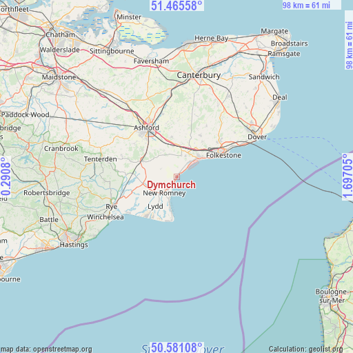
Dymchurch GPS coordinates[2]
51° 1' 31.584" North, 0° 59' 38.112" East
| Map corner | latitude | longitude |
|---|---|---|
| Upper-left | 51.46558°, | 0.2908° |
| Center: | 51.02544°, | 0.99392° |
| Lower-right: | 50.58108°, | 1.69705° |
| Map W x H: | 98.3×98.3 km | = 61.1×61.1mi |
| max Lat: | 60.39635° ⇑90.7% North |
| Dymchurch: | 51.02544° |
| min Lat: | ⇓9.3% South 34.60088° |
| min Long | Dymchurch | max Long |
| -7.64133° | 0.99392° | 32.95536° |
| W 96.4%⇐ | ⇒3.6% E |
Elevation
Elevation of Dymchurch is 2 m = 7 ft, and this is 70.9 m = 233 ft below average elevation for this country.
| Max E: |
515 m = 1690 ft | 99.8% |
| Avg. | 72.9 m = 239 ft | |
| Dymchurch | 2 m = 7 ft | |
Min E: |
-30 m = -98 ft | 0.2% |
See also: United Kingdom elevation on elevation.city.
Geographical zone
Dymchurch is located in North temperate zone (between Tropic of Cancer and the Arctic Circle). Distance of this North polar circle is 1727.7 km =1073.5 mi to North.| Distance of | km | miles | from Dymchurch |
|---|---|---|---|
| North Pole | 4333.6 | 2692.8 | to North |
| Arctic Circle | 1727.7 | 1073.5 | to North |
| Tropic Cancer | 3067.6 | 1906.1 | to South |
| Equator | 5673.5 | 3525.3 | to South |


Nearby cities:
15 places around Dymchurch: (largest is in red/bold)
• Aldington
8.1 km =5 mi,  334°
334°
• Ashford
15.9 km =9.9 mi, 328°
• Folkestone
13.6 km =8.5 mi,  62°
62°
• Hawkinge
15.2 km =9.4 mi,  50°
50°
• Hythe
8.1 km =5 mi, 50°
• Ivychurch
7.5 km =4.7 mi,  259°
259°
• Lydd
10.3 km =6.4 mi,  216°
216°
• Lyminge
13.3 km =8.3 mi,  29°
29°
• Lympne
6.3 km =3.9 mi,  22°
22°
• Mersham
11.3 km =7 mi,  337°
337°
• New Romney
5.7 km =3.5 mi, 220°
• Romney Marsh
5.5 km =3.4 mi,  267°
267°
• Sellindge
8.7 km =5.4 mi,  5°
5°
• Shadoxhurst
15.3 km =9.5 mi,  306°
306°
• St Mary's Bay
2.1 km =1.3 mi,  214°
214°
Sources, notices
• [Note1] Compared only with cities in United Kingdom existing in our database
• [Src1] Map data: © OpenStreetMap contributors (CC-BY-SA)
• [Src2] Other city data from geonames.org with taken over terms of usage.
• [Src3] Geographical zone / Annual Mean Temperature by Robert A. Rohde @ Wikipedia
